You are here: Home > Network List > CI - Caltech Regional Seismic Network Stations List
> Station JCS Julian Camp Stevens, California, USA > Earthquake Result Viewer
JCS Julian Camp Stevens, California, USA - Earthquake Result Viewer

| Earthquake location: |
Fiji Islands Region |
| Earthquake latitude/longitude: |
-21.7/-179.5 |
| Earthquake time(UTC): |
2002/08/19 (231) 11:01:01 GMT |
| Earthquake Depth: |
580 km |
| Earthquake Magnitude: |
6.7 MB, 7.6 MW, 7.7 ME |
| Earthquake Catalog/Contributor: |
WHDF/NEIC |
|
| Network: |
CI Caltech Regional Seismic Network |
| Station: |
JCS Julian Camp Stevens, California, USA |
| Lat/Lon: |
33.09 N/116.60 W |
| Elevation: |
1258 m |
|
| Distance: |
81.0 deg |
| Az: |
49.175 deg |
| Baz: |
236.957 deg |
| Ray Param: |
0.046103068 |
| Estimated Moho Depth: |
33.25 km |
| Estimated Crust Vp/Vs: |
1.85 |
| Assumed Crust Vp: |
6.264 km/s |
| Estimated Crust Vs: |
3.39 km/s |
| Estimated Crust Poisson's Ratio: |
0.29 |
|
| Radial Match: |
96.58439 % |
| Radial Bump: |
400 |
| Transverse Match: |
90.362236 % |
| Transverse Bump: |
400 |
| SOD ConfigId: |
3787 |
| Insert Time: |
2010-02-26 01:53:07.025 +0000 |
| GWidth: |
2.5 |
| Max Bumps: |
400 |
| Tol: |
0.001 |
|
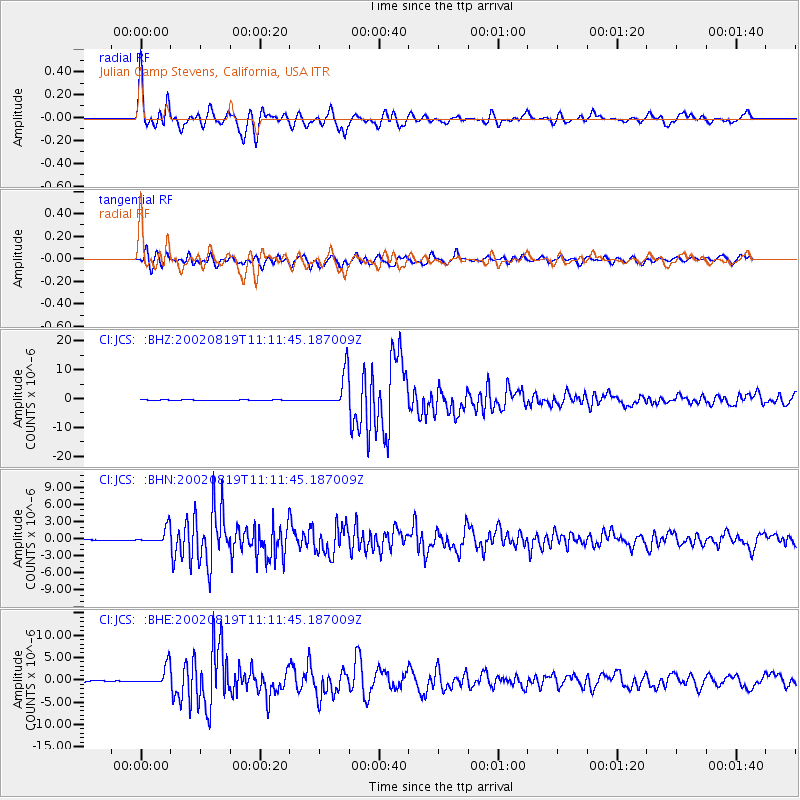
Signal To Noise
| Channel | StoN | STA | LTA |
| CI:JCS: :BHN:20020819T11:11:45.187009Z | 27.339064 | 1.3508949E-6 | 4.9412623E-8 |
| CI:JCS: :BHE:20020819T11:11:45.187009Z | 24.64241 | 2.1370683E-6 | 8.672318E-8 |
| CI:JCS: :BHZ:20020819T11:11:45.187009Z | 67.684326 | 5.8629835E-6 | 8.6622464E-8 |
| Arrivals |
| Ps | 4.6 SECOND |
| PpPs | 15 SECOND |
| PsPs/PpSs | 19 SECOND |


