You are here: Home > Network List > TA - USArray Transportable Network (new EarthScope stations) Stations List
> Station D25K Kavik River, AK, USA > Earthquake Result Viewer
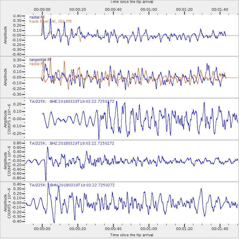
D25K Kavik River, AK, USA - Earthquake Result Viewer
*The percent match for this event was below the threshold and hence no stack was calculated.
| Earthquake location: |
Solomon Islands |
| Earthquake latitude/longitude: |
-9.4/159.6 |
| Earthquake time(UTC): |
2018/03/29 (088) 18:51:09 GMT |
| Earthquake Depth: |
10 km |
| Earthquake Magnitude: |
5.8 Mww |
| Earthquake Catalog/Contributor: |
NEIC PDE/us |
|
| Network: |
TA USArray Transportable Network (new EarthScope stations) |
| Station: |
D25K Kavik River, AK, USA |
| Lat/Lon: |
69.32 N/146.38 W |
| Elevation: |
770 m |
|
| Distance: |
86.9 deg |
| Az: |
16.739 deg |
| Baz: |
233.135 deg |
| Ray Param: |
$rayparam |
*The percent match for this event was below the threshold and hence was not used in the summary stack. |
|
| Radial Match: |
75.84915 % |
| Radial Bump: |
400 |
| Transverse Match: |
62.8581 % |
| Transverse Bump: |
400 |
| SOD ConfigId: |
13570011 |
| Insert Time: |
2019-04-30 00:48:35.841 +0000 |
| GWidth: |
2.5 |
| Max Bumps: |
400 |
| Tol: |
0.001 |
|
Signal To Noise
| Channel | StoN | STA | LTA |
| TA:D25K: :BHZ:20180329T19:03:22.725027Z | 5.4434304 | 3.328298E-7 | 6.1143396E-8 |
| TA:D25K: :BHN:20180329T19:03:22.725027Z | 1.6950116 | 1.9229081E-7 | 1.1344513E-7 |
| TA:D25K: :BHE:20180329T19:03:22.725027Z | 1.8660679 | 9.867768E-8 | 5.2880004E-8 |
| Arrivals |
| Ps | |
| PpPs | |
| PsPs/PpSs | |


