You are here: Home > Network List > TA - USArray Transportable Network (new EarthScope stations) Stations List
> Station I17K Unalakleet, AK, USA > Earthquake Result Viewer
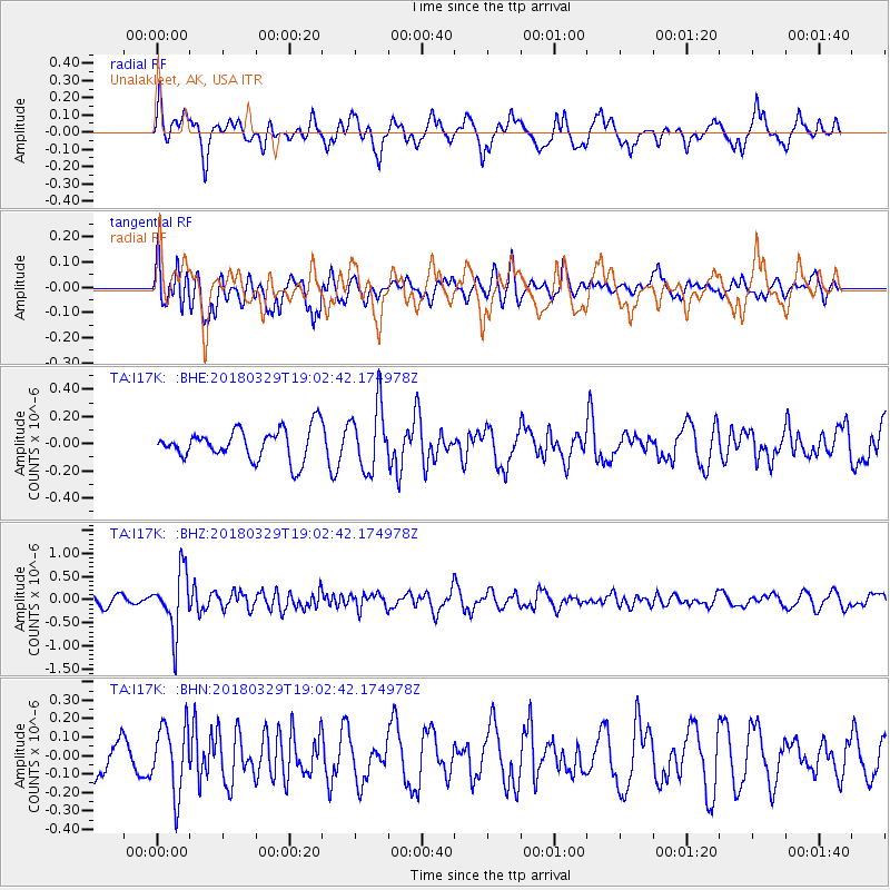
I17K Unalakleet, AK, USA - Earthquake Result Viewer
*The percent match for this event was below the threshold and hence no stack was calculated.
| Earthquake location: |
Solomon Islands |
| Earthquake latitude/longitude: |
-9.4/159.6 |
| Earthquake time(UTC): |
2018/03/29 (088) 18:51:09 GMT |
| Earthquake Depth: |
10 km |
| Earthquake Magnitude: |
5.8 Mww |
| Earthquake Catalog/Contributor: |
NEIC PDE/us |
|
| Network: |
TA USArray Transportable Network (new EarthScope stations) |
| Station: |
I17K Unalakleet, AK, USA |
| Lat/Lon: |
63.89 N/160.70 W |
| Elevation: |
105 m |
|
| Distance: |
79.1 deg |
| Az: |
16.75 deg |
| Baz: |
219.982 deg |
| Ray Param: |
$rayparam |
*The percent match for this event was below the threshold and hence was not used in the summary stack. |
|
| Radial Match: |
64.63409 % |
| Radial Bump: |
400 |
| Transverse Match: |
67.25887 % |
| Transverse Bump: |
400 |
| SOD ConfigId: |
13570011 |
| Insert Time: |
2019-04-30 00:49:14.080 +0000 |
| GWidth: |
2.5 |
| Max Bumps: |
400 |
| Tol: |
0.001 |
|
Signal To Noise
| Channel | StoN | STA | LTA |
| TA:I17K: :BHZ:20180329T19:02:42.174978Z | 4.6069074 | 6.353328E-7 | 1.3790874E-7 |
| TA:I17K: :BHN:20180329T19:02:42.174978Z | 1.6430333 | 1.8282907E-7 | 1.11275334E-7 |
| TA:I17K: :BHE:20180329T19:02:42.174978Z | 2.126472 | 2.3535306E-7 | 1.1067771E-7 |
| Arrivals |
| Ps | |
| PpPs | |
| PsPs/PpSs | |


