You are here: Home > Network List > AV - Alaska Volcano Observatory Stations List
> Station AMKA Regional Station, Amchitka Island, Alaska > Earthquake Result Viewer
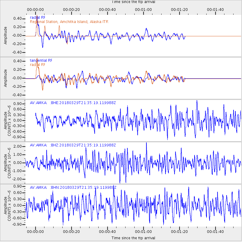
AMKA Regional Station, Amchitka Island, Alaska - Earthquake Result Viewer
*The percent match for this event was below the threshold and hence no stack was calculated.
| Earthquake location: |
New Britain Region, P.N.G. |
| Earthquake latitude/longitude: |
-5.5/151.4 |
| Earthquake time(UTC): |
2018/03/29 (088) 21:25:32 GMT |
| Earthquake Depth: |
10 km |
| Earthquake Magnitude: |
6.9 mww |
| Earthquake Catalog/Contributor: |
NEIC PDE/us |
|
| Network: |
AV Alaska Volcano Observatory |
| Station: |
AMKA Regional Station, Amchitka Island, Alaska |
| Lat/Lon: |
51.38 N/179.30 E |
| Elevation: |
116 m |
|
| Distance: |
61.5 deg |
| Az: |
19.47 deg |
| Baz: |
211.968 deg |
| Ray Param: |
$rayparam |
*The percent match for this event was below the threshold and hence was not used in the summary stack. |
|
| Radial Match: |
66.56739 % |
| Radial Bump: |
400 |
| Transverse Match: |
48.447197 % |
| Transverse Bump: |
400 |
| SOD ConfigId: |
13570011 |
| Insert Time: |
2019-04-30 00:53:24.832 +0000 |
| GWidth: |
2.5 |
| Max Bumps: |
400 |
| Tol: |
0.001 |
|
Signal To Noise
| Channel | StoN | STA | LTA |
| AV:AMKA: :BHZ:20180329T21:35:19.119988Z | 2.806436 | 4.922796E-7 | 1.7541095E-7 |
| AV:AMKA: :BHN:20180329T21:35:19.119988Z | 0.8161198 | 1.7721881E-7 | 2.1714804E-7 |
| AV:AMKA: :BHE:20180329T21:35:19.119988Z | 1.5801139 | 3.2067976E-7 | 2.0294725E-7 |
| Arrivals |
| Ps | |
| PpPs | |
| PsPs/PpSs | |


