You are here: Home > Network List > AV - Alaska Volcano Observatory Stations List
> Station MAPS Pakushin Southeast, Makushin Volcano, Alaska > Earthquake Result Viewer
MAPS Pakushin Southeast, Makushin Volcano, Alaska - Earthquake Result Viewer

| Earthquake location: |
New Britain Region, P.N.G. |
| Earthquake latitude/longitude: |
-5.5/151.4 |
| Earthquake time(UTC): |
2018/03/29 (088) 21:25:32 GMT |
| Earthquake Depth: |
10 km |
| Earthquake Magnitude: |
6.9 mww |
| Earthquake Catalog/Contributor: |
NEIC PDE/us |
|
| Network: |
AV Alaska Volcano Observatory |
| Station: |
MAPS Pakushin Southeast, Makushin Volcano, Alaska |
| Lat/Lon: |
53.81 N/166.94 W |
| Elevation: |
333 m |
|
| Distance: |
68.6 deg |
| Az: |
25.027 deg |
| Baz: |
225.243 deg |
| Ray Param: |
0.056208886 |
| Estimated Moho Depth: |
25.0 km |
| Estimated Crust Vp/Vs: |
1.67 |
| Assumed Crust Vp: |
3.943 km/s |
| Estimated Crust Vs: |
2.358 km/s |
| Estimated Crust Poisson's Ratio: |
0.22 |
|
| Radial Match: |
83.51698 % |
| Radial Bump: |
400 |
| Transverse Match: |
63.74758 % |
| Transverse Bump: |
400 |
| SOD ConfigId: |
13570011 |
| Insert Time: |
2019-04-30 00:53:36.515 +0000 |
| GWidth: |
2.5 |
| Max Bumps: |
400 |
| Tol: |
0.001 |
|
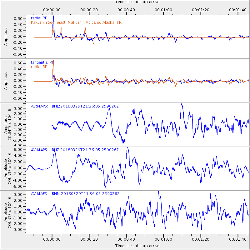
Signal To Noise
| Channel | StoN | STA | LTA |
| AV:MAPS: :BHZ:20180329T21:36:05.259026Z | 6.1175475 | 3.102907E-6 | 5.0721417E-7 |
| AV:MAPS: :BHN:20180329T21:36:05.259026Z | 1.9288547 | 7.020685E-7 | 3.6398205E-7 |
| AV:MAPS: :BHE:20180329T21:36:05.259026Z | 3.8239276 | 1.8924524E-6 | 4.948975E-7 |
| Arrivals |
| Ps | 4.3 SECOND |
| PpPs | 17 SECOND |
| PsPs/PpSs | 21 SECOND |


