You are here: Home > Network List > TA - USArray Transportable Network (new EarthScope stations) Stations List
> Station Y25A Mesa, Roswell, NM, USA > Earthquake Result Viewer
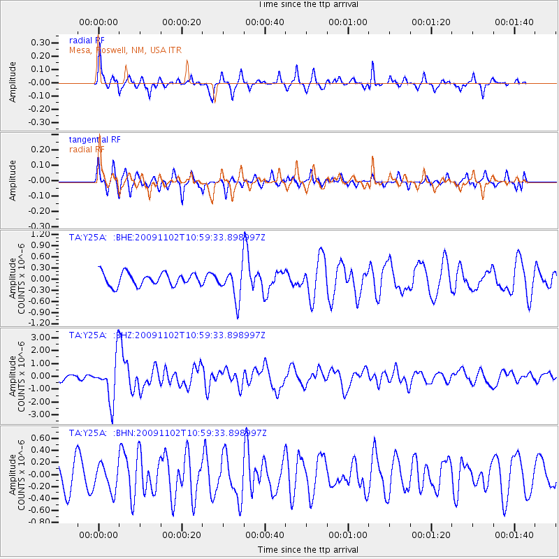
Y25A Mesa, Roswell, NM, USA - Earthquake Result Viewer
*The percent match for this event was below the threshold and hence no stack was calculated.
| Earthquake location: |
South Of Tonga Islands |
| Earthquake latitude/longitude: |
-24.1/-175.2 |
| Earthquake time(UTC): |
2009/11/02 (306) 10:47:13 GMT |
| Earthquake Depth: |
9.0 km |
| Earthquake Magnitude: |
6.1 MB, 6.1 MS, 6.2 MW, 6.1 MW |
| Earthquake Catalog/Contributor: |
WHDF/NEIC |
|
| Network: |
TA USArray Transportable Network (new EarthScope stations) |
| Station: |
Y25A Mesa, Roswell, NM, USA |
| Lat/Lon: |
33.92 N/104.69 W |
| Elevation: |
1364 m |
|
| Distance: |
88.4 deg |
| Az: |
51.632 deg |
| Baz: |
239.489 deg |
| Ray Param: |
$rayparam |
*The percent match for this event was below the threshold and hence was not used in the summary stack. |
|
| Radial Match: |
84.063255 % |
| Radial Bump: |
301 |
| Transverse Match: |
58.023994 % |
| Transverse Bump: |
308 |
| SOD ConfigId: |
2622 |
| Insert Time: |
2010-03-06 10:09:13.412 +0000 |
| GWidth: |
2.5 |
| Max Bumps: |
400 |
| Tol: |
0.001 |
|
Signal To Noise
| Channel | StoN | STA | LTA |
| TA:Y25A: :BHZ:20091102T10:59:33.898997Z | 5.6884093 | 1.7717417E-6 | 3.1146521E-7 |
| TA:Y25A: :BHN:20091102T10:59:33.898997Z | 0.6002145 | 2.2025291E-7 | 3.66957E-7 |
| TA:Y25A: :BHE:20091102T10:59:33.898997Z | 2.6259365 | 4.4406042E-7 | 1.6910553E-7 |
| Arrivals |
| Ps | |
| PpPs | |
| PsPs/PpSs | |


