You are here: Home > Network List > US - United States National Seismic Network Stations List
> Station DGMT Dagmar, Montana, USA > Earthquake Result Viewer
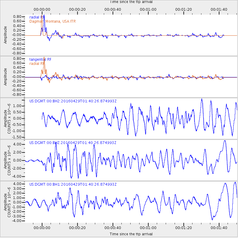
DGMT Dagmar, Montana, USA - Earthquake Result Viewer
*The percent match for this event was below the threshold and hence no stack was calculated.
| Earthquake location: |
Northern East Pacific Rise |
| Earthquake latitude/longitude: |
10.3/-103.8 |
| Earthquake time(UTC): |
2016/04/29 (120) 01:33:38 GMT |
| Earthquake Depth: |
10 km |
| Earthquake Magnitude: |
6.8 MWP, 6.9 MI |
| Earthquake Catalog/Contributor: |
NEIC PDE/NEIC COMCAT |
|
| Network: |
US United States National Seismic Network |
| Station: |
DGMT Dagmar, Montana, USA |
| Lat/Lon: |
48.47 N/104.20 W |
| Elevation: |
0.0 m |
|
| Distance: |
38.1 deg |
| Az: |
359.532 deg |
| Baz: |
179.308 deg |
| Ray Param: |
$rayparam |
*The percent match for this event was below the threshold and hence was not used in the summary stack. |
|
| Radial Match: |
88.71107 % |
| Radial Bump: |
275 |
| Transverse Match: |
70.698814 % |
| Transverse Bump: |
400 |
| SOD ConfigId: |
1475611 |
| Insert Time: |
2016-05-13 01:40:55.651 +0000 |
| GWidth: |
2.5 |
| Max Bumps: |
400 |
| Tol: |
0.001 |
|
Signal To Noise
| Channel | StoN | STA | LTA |
| US:DGMT:00:BHZ:20160429T01:40:26.874993Z | 8.722261 | 1.0244491E-6 | 1.1745223E-7 |
| US:DGMT:00:BH1:20160429T01:40:26.874993Z | 3.0982397 | 7.5705805E-7 | 2.44351E-7 |
| US:DGMT:00:BH2:20160429T01:40:26.874993Z | 0.45613185 | 1.5934485E-7 | 3.4933947E-7 |
| Arrivals |
| Ps | |
| PpPs | |
| PsPs/PpSs | |


