You are here: Home > Network List > TA - USArray Transportable Network (new EarthScope stations) Stations List
> Station Y25A Mesa, Roswell, NM, USA > Earthquake Result Viewer
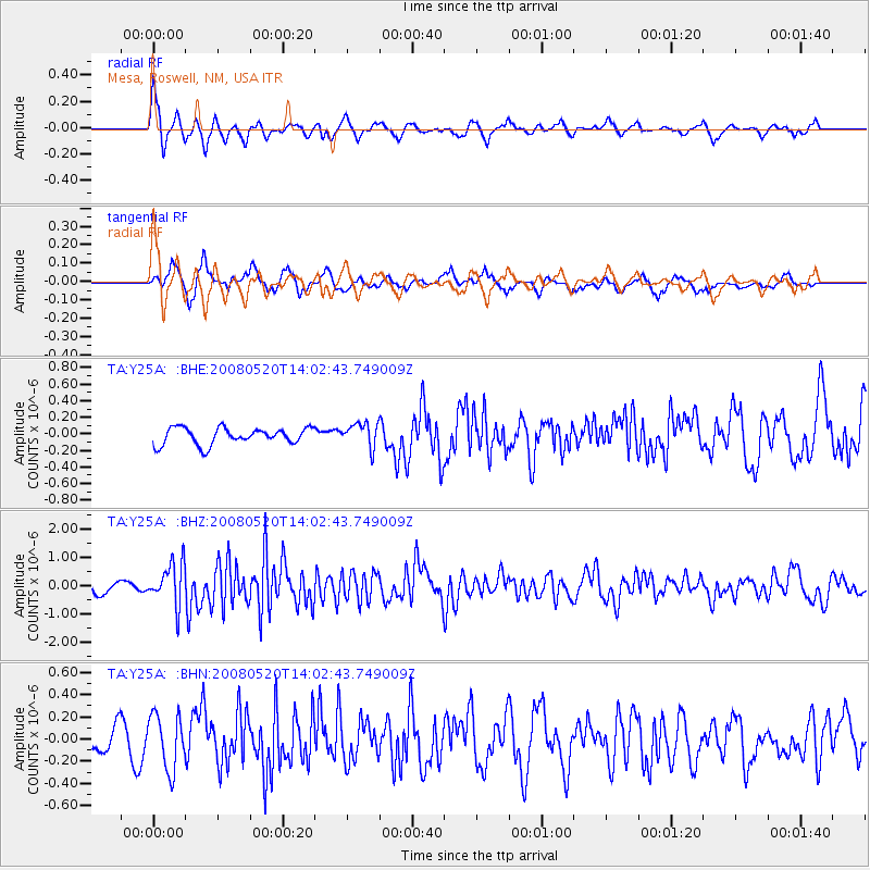
Y25A Mesa, Roswell, NM, USA - Earthquake Result Viewer
*The percent match for this event was below the threshold and hence no stack was calculated.
| Earthquake location: |
Rat Islands, Aleutian Islands |
| Earthquake latitude/longitude: |
51.2/178.8 |
| Earthquake time(UTC): |
2008/05/20 (141) 13:53:35 GMT |
| Earthquake Depth: |
27 km |
| Earthquake Magnitude: |
5.8 MB, 6.0 MS, 6.3 MW, 6.3 MW |
| Earthquake Catalog/Contributor: |
WHDF/NEIC |
|
| Network: |
TA USArray Transportable Network (new EarthScope stations) |
| Station: |
Y25A Mesa, Roswell, NM, USA |
| Lat/Lon: |
33.92 N/104.69 W |
| Elevation: |
1364 m |
|
| Distance: |
56.4 deg |
| Az: |
76.142 deg |
| Baz: |
312.675 deg |
| Ray Param: |
$rayparam |
*The percent match for this event was below the threshold and hence was not used in the summary stack. |
|
| Radial Match: |
65.10656 % |
| Radial Bump: |
400 |
| Transverse Match: |
66.50853 % |
| Transverse Bump: |
400 |
| SOD ConfigId: |
2504 |
| Insert Time: |
2010-03-06 10:10:32.838 +0000 |
| GWidth: |
2.5 |
| Max Bumps: |
400 |
| Tol: |
0.001 |
|
Signal To Noise
| Channel | StoN | STA | LTA |
| TA:Y25A: :BHZ:20080520T14:02:43.749009Z | 4.087162 | 7.4291114E-7 | 1.8176699E-7 |
| TA:Y25A: :BHN:20080520T14:02:43.749009Z | 1.5451932 | 2.4433524E-7 | 1.5812601E-7 |
| TA:Y25A: :BHE:20080520T14:02:43.749009Z | 1.4812226 | 1.4882077E-7 | 1.00471574E-7 |
| Arrivals |
| Ps | |
| PpPs | |
| PsPs/PpSs | |


