You are here: Home > Network List > UW - Pacific Northwest Regional Seismic Network Stations List
> Station LEBA Lebam, WA, USA > Earthquake Result Viewer
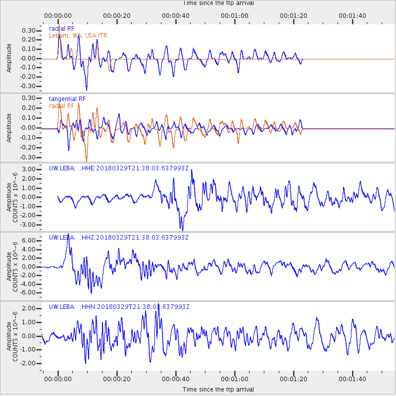
LEBA Lebam, WA, USA - Earthquake Result Viewer
*The percent match for this event was below the threshold and hence no stack was calculated.
| Earthquake location: |
New Britain Region, P.N.G. |
| Earthquake latitude/longitude: |
-5.5/151.4 |
| Earthquake time(UTC): |
2018/03/29 (088) 21:25:32 GMT |
| Earthquake Depth: |
10 km |
| Earthquake Magnitude: |
6.9 mww |
| Earthquake Catalog/Contributor: |
NEIC PDE/us |
|
| Network: |
UW Pacific Northwest Regional Seismic Network |
| Station: |
LEBA Lebam, WA, USA |
| Lat/Lon: |
46.55 N/123.56 W |
| Elevation: |
73 m |
|
| Distance: |
90.5 deg |
| Az: |
43.44 deg |
| Baz: |
262.626 deg |
| Ray Param: |
$rayparam |
*The percent match for this event was below the threshold and hence was not used in the summary stack. |
|
| Radial Match: |
80.924545 % |
| Radial Bump: |
400 |
| Transverse Match: |
76.465324 % |
| Transverse Bump: |
400 |
| SOD ConfigId: |
13570011 |
| Insert Time: |
2019-04-30 01:01:59.353 +0000 |
| GWidth: |
2.5 |
| Max Bumps: |
400 |
| Tol: |
0.001 |
|
Signal To Noise
| Channel | StoN | STA | LTA |
| UW:LEBA: :HHZ:20180329T21:38:03.637993Z | 17.170551 | 3.1790646E-6 | 1.8514633E-7 |
| UW:LEBA: :HHN:20180329T21:38:03.637993Z | 0.53999794 | 1.4797108E-7 | 2.7402157E-7 |
| UW:LEBA: :HHE:20180329T21:38:03.637993Z | 2.822697 | 8.808533E-7 | 3.1206088E-7 |
| Arrivals |
| Ps | |
| PpPs | |
| PsPs/PpSs | |


