You are here: Home > Network List > AV - Alaska Volcano Observatory Stations List
> Station MAPS Pakushin Southeast, Makushin Volcano, Alaska > Earthquake Result Viewer
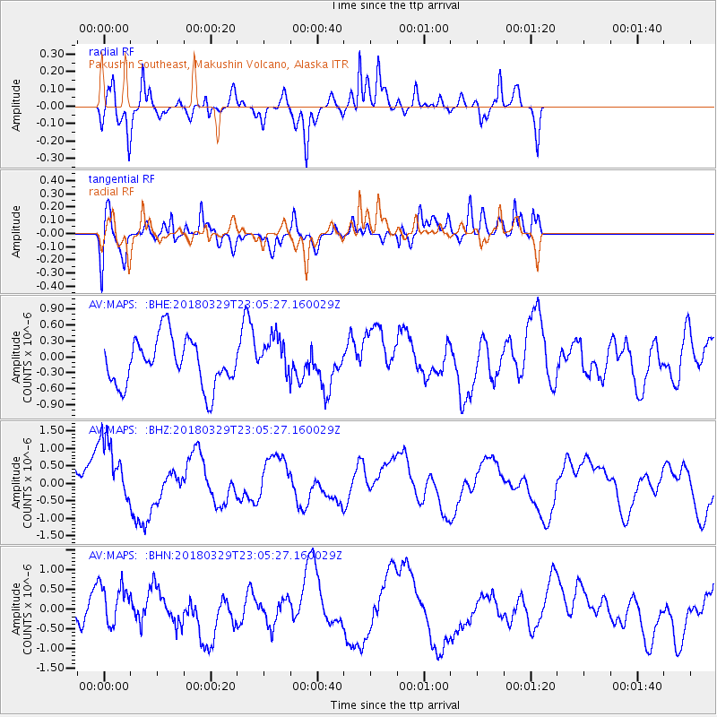
MAPS Pakushin Southeast, Makushin Volcano, Alaska - Earthquake Result Viewer
*The percent match for this event was below the threshold and hence no stack was calculated.
| Earthquake location: |
Tajikistan |
| Earthquake latitude/longitude: |
38.7/70.0 |
| Earthquake time(UTC): |
2018/03/29 (088) 22:54:12 GMT |
| Earthquake Depth: |
3.6 km |
| Earthquake Magnitude: |
5.6 mb |
| Earthquake Catalog/Contributor: |
NEIC PDE/us |
|
| Network: |
AV Alaska Volcano Observatory |
| Station: |
MAPS Pakushin Southeast, Makushin Volcano, Alaska |
| Lat/Lon: |
53.81 N/166.94 W |
| Elevation: |
333 m |
|
| Distance: |
75.6 deg |
| Az: |
30.856 deg |
| Baz: |
317.445 deg |
| Ray Param: |
$rayparam |
*The percent match for this event was below the threshold and hence was not used in the summary stack. |
|
| Radial Match: |
65.717834 % |
| Radial Bump: |
338 |
| Transverse Match: |
65.869385 % |
| Transverse Bump: |
400 |
| SOD ConfigId: |
13570011 |
| Insert Time: |
2019-04-30 01:08:36.933 +0000 |
| GWidth: |
2.5 |
| Max Bumps: |
400 |
| Tol: |
0.001 |
|
Signal To Noise
| Channel | StoN | STA | LTA |
| AV:MAPS: :BHZ:20180329T23:05:27.160029Z | 1.5101622 | 1.0041083E-6 | 6.6490094E-7 |
| AV:MAPS: :BHN:20180329T23:05:27.160029Z | 0.78059477 | 5.163347E-7 | 6.6146316E-7 |
| AV:MAPS: :BHE:20180329T23:05:27.160029Z | 0.8895507 | 3.9825315E-7 | 4.4770147E-7 |
| Arrivals |
| Ps | |
| PpPs | |
| PsPs/PpSs | |


