You are here: Home > Network List > TA - USArray Transportable Network (new EarthScope stations) Stations List
> Station I30M Mount Dempster, Yukon, CAN > Earthquake Result Viewer
I30M Mount Dempster, Yukon, CAN - Earthquake Result Viewer
*The percent match for this event was below the threshold and hence no stack was calculated.
| Earthquake location: |
Tajikistan |
| Earthquake latitude/longitude: |
38.7/70.0 |
| Earthquake time(UTC): |
2018/03/29 (088) 22:54:12 GMT |
| Earthquake Depth: |
3.6 km |
| Earthquake Magnitude: |
5.6 mb |
| Earthquake Catalog/Contributor: |
NEIC PDE/us |
|
| Network: |
TA USArray Transportable Network (new EarthScope stations) |
| Station: |
I30M Mount Dempster, Yukon, CAN |
| Lat/Lon: |
65.22 N/136.38 W |
| Elevation: |
1399 m |
|
| Distance: |
74.3 deg |
| Az: |
11.194 deg |
| Baz: |
338.885 deg |
| Ray Param: |
$rayparam |
*The percent match for this event was below the threshold and hence was not used in the summary stack. |
|
| Radial Match: |
57.935623 % |
| Radial Bump: |
400 |
| Transverse Match: |
81.26697 % |
| Transverse Bump: |
400 |
| SOD ConfigId: |
13570011 |
| Insert Time: |
2019-04-30 01:11:55.984 +0000 |
| GWidth: |
2.5 |
| Max Bumps: |
400 |
| Tol: |
0.001 |
|
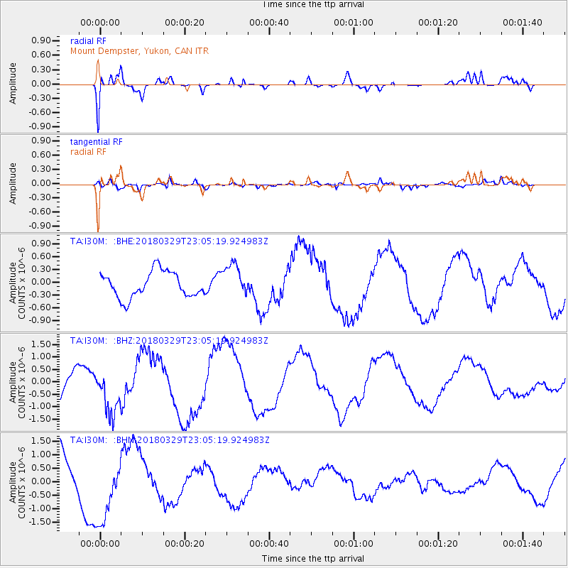
Signal To Noise
| Channel | StoN | STA | LTA |
| TA:I30M: :BHZ:20180329T23:05:19.924983Z | 2.0348628 | 9.354938E-7 | 4.5973312E-7 |
| TA:I30M: :BHN:20180329T23:05:19.924983Z | 1.605332 | 1.2332986E-6 | 7.6825137E-7 |
| TA:I30M: :BHE:20180329T23:05:19.924983Z | 1.2881716 | 3.8633928E-7 | 2.999129E-7 |
| Arrivals |
| Ps | |
| PpPs | |
| PsPs/PpSs | |


