You are here: Home > Network List > II - Global Seismograph Network (GSN - IRIS/IDA) Stations List
> Station WRAB Tennant Creek, NT, Australia > Earthquake Result Viewer
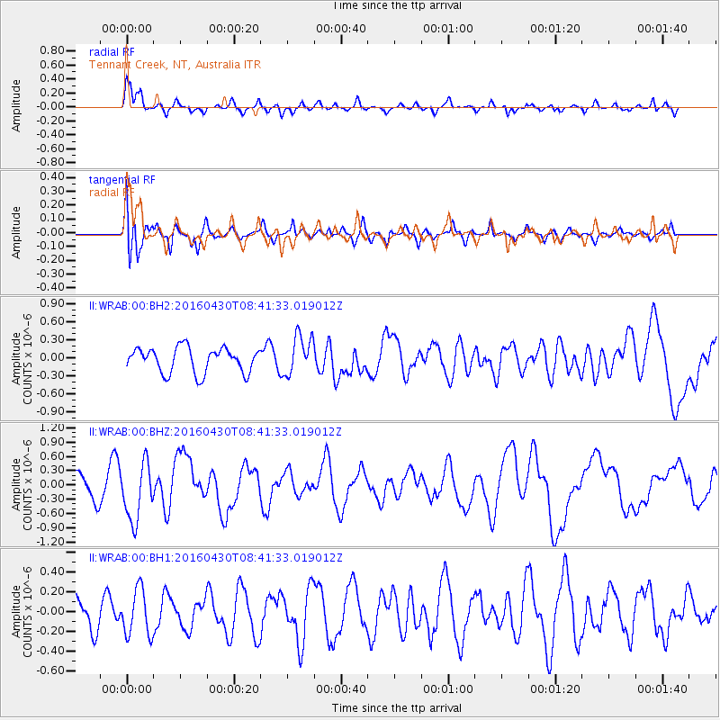
WRAB Tennant Creek, NT, Australia - Earthquake Result Viewer
*The percent match for this event was below the threshold and hence no stack was calculated.
| Earthquake location: |
Vanuatu Islands |
| Earthquake latitude/longitude: |
-16.3/167.2 |
| Earthquake time(UTC): |
2016/04/30 (121) 08:35:42 GMT |
| Earthquake Depth: |
4.7 km |
| Earthquake Magnitude: |
6.0 MO |
| Earthquake Catalog/Contributor: |
NEIC PDE/NEIC ALERT |
|
| Network: |
II Global Seismograph Network (GSN - IRIS/IDA) |
| Station: |
WRAB Tennant Creek, NT, Australia |
| Lat/Lon: |
19.93 S/134.36 E |
| Elevation: |
366 m |
|
| Distance: |
31.4 deg |
| Az: |
258.382 deg |
| Baz: |
88.793 deg |
| Ray Param: |
$rayparam |
*The percent match for this event was below the threshold and hence was not used in the summary stack. |
|
| Radial Match: |
79.52401 % |
| Radial Bump: |
355 |
| Transverse Match: |
68.38206 % |
| Transverse Bump: |
400 |
| SOD ConfigId: |
1475611 |
| Insert Time: |
2016-05-14 08:39:36.607 +0000 |
| GWidth: |
2.5 |
| Max Bumps: |
400 |
| Tol: |
0.001 |
|
Signal To Noise
| Channel | StoN | STA | LTA |
| II:WRAB:00:BHZ:20160430T08:41:33.019012Z | 1.61478 | 6.036532E-7 | 3.7382998E-7 |
| II:WRAB:00:BH1:20160430T08:41:33.019012Z | 0.9733566 | 2.3490888E-7 | 2.4133897E-7 |
| II:WRAB:00:BH2:20160430T08:41:33.019012Z | 1.5731705 | 3.2697173E-7 | 2.0784252E-7 |
| Arrivals |
| Ps | |
| PpPs | |
| PsPs/PpSs | |


