You are here: Home > Network List > TA - USArray Transportable Network (new EarthScope stations) Stations List
> Station I30M Mount Dempster, Yukon, CAN > Earthquake Result Viewer
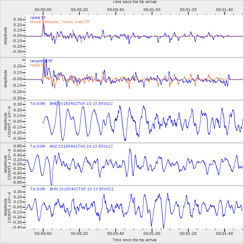
I30M Mount Dempster, Yukon, CAN - Earthquake Result Viewer
*The percent match for this event was below the threshold and hence no stack was calculated.
| Earthquake location: |
South Of Fiji Islands |
| Earthquake latitude/longitude: |
-24.9/-176.6 |
| Earthquake time(UTC): |
2018/04/02 (092) 05:57:31 GMT |
| Earthquake Depth: |
84 km |
| Earthquake Magnitude: |
6.1 Mww |
| Earthquake Catalog/Contributor: |
NEIC PDE/us |
|
| Network: |
TA USArray Transportable Network (new EarthScope stations) |
| Station: |
I30M Mount Dempster, Yukon, CAN |
| Lat/Lon: |
65.22 N/136.38 W |
| Elevation: |
1399 m |
|
| Distance: |
95.0 deg |
| Az: |
15.856 deg |
| Baz: |
216.07 deg |
| Ray Param: |
$rayparam |
*The percent match for this event was below the threshold and hence was not used in the summary stack. |
|
| Radial Match: |
65.6447 % |
| Radial Bump: |
400 |
| Transverse Match: |
61.087536 % |
| Transverse Bump: |
400 |
| SOD ConfigId: |
13570011 |
| Insert Time: |
2019-04-30 01:20:11.731 +0000 |
| GWidth: |
2.5 |
| Max Bumps: |
400 |
| Tol: |
0.001 |
|
Signal To Noise
| Channel | StoN | STA | LTA |
| TA:I30M: :BHZ:20180402T06:10:13.85002Z | 2.2639914 | 4.2386674E-7 | 1.87221E-7 |
| TA:I30M: :BHN:20180402T06:10:13.85002Z | 0.90777856 | 6.737275E-8 | 7.421717E-8 |
| TA:I30M: :BHE:20180402T06:10:13.85002Z | 0.64142317 | 1.1230598E-7 | 1.7508876E-7 |
| Arrivals |
| Ps | |
| PpPs | |
| PsPs/PpSs | |


