You are here: Home > Network List > TA - USArray Transportable Network (new EarthScope stations) Stations List
> Station K15K Wolf Creek Mountain, AK, USA > Earthquake Result Viewer
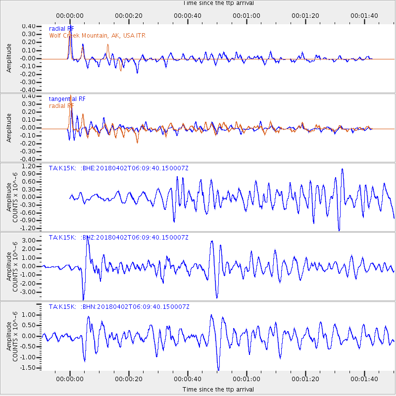
K15K Wolf Creek Mountain, AK, USA - Earthquake Result Viewer
*The percent match for this event was below the threshold and hence no stack was calculated.
| Earthquake location: |
South Of Fiji Islands |
| Earthquake latitude/longitude: |
-24.9/-176.6 |
| Earthquake time(UTC): |
2018/04/02 (092) 05:57:31 GMT |
| Earthquake Depth: |
84 km |
| Earthquake Magnitude: |
6.1 Mww |
| Earthquake Catalog/Contributor: |
NEIC PDE/us |
|
| Network: |
TA USArray Transportable Network (new EarthScope stations) |
| Station: |
K15K Wolf Creek Mountain, AK, USA |
| Lat/Lon: |
62.29 N/161.53 W |
| Elevation: |
346 m |
|
| Distance: |
87.7 deg |
| Az: |
6.988 deg |
| Baz: |
193.673 deg |
| Ray Param: |
$rayparam |
*The percent match for this event was below the threshold and hence was not used in the summary stack. |
|
| Radial Match: |
85.624664 % |
| Radial Bump: |
311 |
| Transverse Match: |
81.19497 % |
| Transverse Bump: |
387 |
| SOD ConfigId: |
13570011 |
| Insert Time: |
2019-04-30 01:20:16.828 +0000 |
| GWidth: |
2.5 |
| Max Bumps: |
400 |
| Tol: |
0.001 |
|
Signal To Noise
| Channel | StoN | STA | LTA |
| TA:K15K: :BHZ:20180402T06:09:40.150007Z | 15.047922 | 1.1479649E-6 | 7.6287265E-8 |
| TA:K15K: :BHN:20180402T06:09:40.150007Z | 2.0122313 | 2.6518822E-7 | 1.3178813E-7 |
| TA:K15K: :BHE:20180402T06:09:40.150007Z | 2.2134454 | 2.6465042E-7 | 1.1956492E-7 |
| Arrivals |
| Ps | |
| PpPs | |
| PsPs/PpSs | |


