You are here: Home > Network List > TA - USArray Transportable Network (new EarthScope stations) Stations List
> Station K14A Jones Ranch, Declo, ID, USA > Earthquake Result Viewer
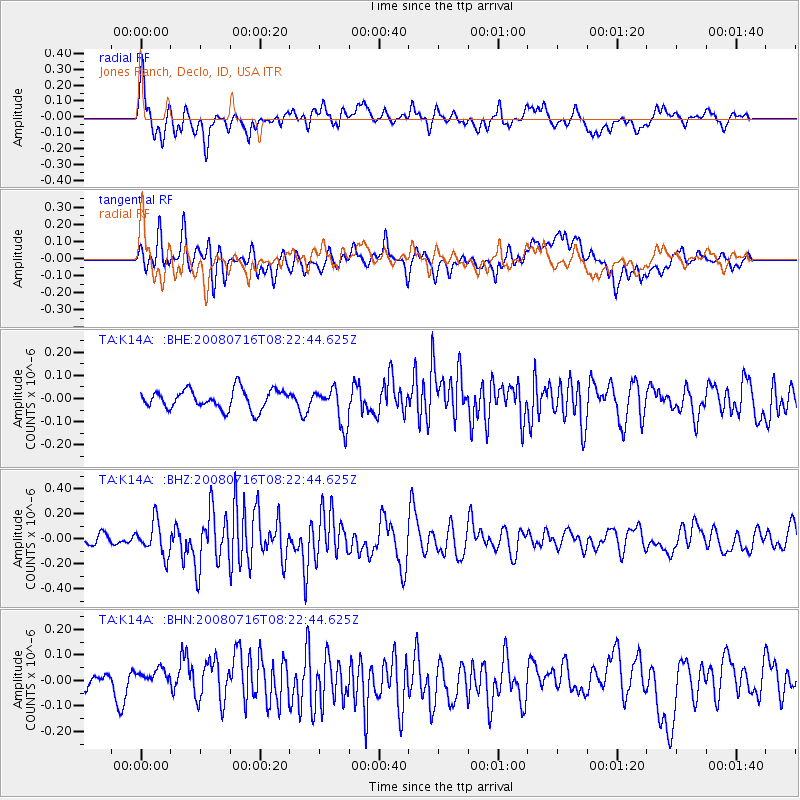
K14A Jones Ranch, Declo, ID, USA - Earthquake Result Viewer
*The percent match for this event was below the threshold and hence no stack was calculated.
| Earthquake location: |
Samoa Islands Region |
| Earthquake latitude/longitude: |
-16.6/-173.0 |
| Earthquake time(UTC): |
2008/07/16 (198) 08:11:04 GMT |
| Earthquake Depth: |
10 km |
| Earthquake Magnitude: |
5.5 MB, 5.4 MS, 5.7 MW, 5.7 MW |
| Earthquake Catalog/Contributor: |
WHDF/NEIC |
|
| Network: |
TA USArray Transportable Network (new EarthScope stations) |
| Station: |
K14A Jones Ranch, Declo, ID, USA |
| Lat/Lon: |
42.55 N/113.18 W |
| Elevation: |
1387 m |
|
| Distance: |
80.5 deg |
| Az: |
40.355 deg |
| Baz: |
237.157 deg |
| Ray Param: |
$rayparam |
*The percent match for this event was below the threshold and hence was not used in the summary stack. |
|
| Radial Match: |
75.42962 % |
| Radial Bump: |
400 |
| Transverse Match: |
75.61788 % |
| Transverse Bump: |
400 |
| SOD ConfigId: |
2504 |
| Insert Time: |
2010-03-06 10:17:44.119 +0000 |
| GWidth: |
2.5 |
| Max Bumps: |
400 |
| Tol: |
0.001 |
|
Signal To Noise
| Channel | StoN | STA | LTA |
| TA:K14A: :BHZ:20080716T08:22:44.625Z | 3.4701734 | 1.323304E-7 | 3.8133656E-8 |
| TA:K14A: :BHN:20080716T08:22:44.625Z | 1.1045488 | 5.5461403E-8 | 5.0211813E-8 |
| TA:K14A: :BHE:20080716T08:22:44.625Z | 1.9715022 | 8.244103E-8 | 4.181635E-8 |
| Arrivals |
| Ps | |
| PpPs | |
| PsPs/PpSs | |


