You are here: Home > Network List > UU - University of Utah Regional Network Stations List
> Station KNB Kanab, UT, USA > Earthquake Result Viewer
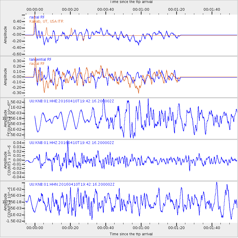
KNB Kanab, UT, USA - Earthquake Result Viewer
*The percent match for this event was below the threshold and hence no stack was calculated.
| Earthquake location: |
Rat Islands, Aleutian Islands |
| Earthquake latitude/longitude: |
51.1/179.5 |
| Earthquake time(UTC): |
2016/04/10 (101) 19:34:02 GMT |
| Earthquake Depth: |
19 km |
| Earthquake Magnitude: |
5.6 MWW, 5.3 ML, 5.4 MWB, 5.6 MWC, 5.7 ML |
| Earthquake Catalog/Contributor: |
NEIC PDE/NEIC COMCAT |
|
| Network: |
UU University of Utah Regional Network |
| Station: |
KNB Kanab, UT, USA |
| Lat/Lon: |
37.02 N/112.82 W |
| Elevation: |
1715 m |
|
| Distance: |
48.9 deg |
| Az: |
79.19 deg |
| Baz: |
309.343 deg |
| Ray Param: |
$rayparam |
*The percent match for this event was below the threshold and hence was not used in the summary stack. |
|
| Radial Match: |
60.790886 % |
| Radial Bump: |
400 |
| Transverse Match: |
67.47399 % |
| Transverse Bump: |
309 |
| SOD ConfigId: |
1475611 |
| Insert Time: |
2016-05-15 15:53:05.390 +0000 |
| GWidth: |
2.5 |
| Max Bumps: |
400 |
| Tol: |
0.001 |
|
Signal To Noise
| Channel | StoN | STA | LTA |
| UU:KNB:01:HHZ:20160410T19:42:16.200002Z | 3.2131987 | 8.394376E-9 | 2.6124671E-9 |
| UU:KNB:01:HHN:20160410T19:42:16.200002Z | 1.4397339 | 4.721572E-9 | 3.2794758E-9 |
| UU:KNB:01:HHE:20160410T19:42:16.200002Z | 1.0018914 | 5.1183795E-9 | 5.108717E-9 |
| Arrivals |
| Ps | |
| PpPs | |
| PsPs/PpSs | |


