You are here: Home > Network List > UW - Pacific Northwest Regional Seismic Network Stations List
> Station FISH Seaside, OR, USA > Earthquake Result Viewer
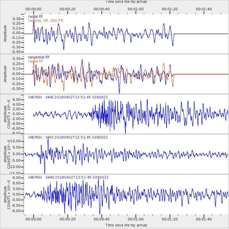
FISH Seaside, OR, USA - Earthquake Result Viewer
*The percent match for this event was below the threshold and hence no stack was calculated.
| Earthquake location: |
Southern Bolivia |
| Earthquake latitude/longitude: |
-20.7/-63.0 |
| Earthquake time(UTC): |
2018/04/02 (092) 13:40:34 GMT |
| Earthquake Depth: |
562 km |
| Earthquake Magnitude: |
6.8 Mww |
| Earthquake Catalog/Contributor: |
NEIC PDE/us |
|
| Network: |
UW Pacific Northwest Regional Seismic Network |
| Station: |
FISH Seaside, OR, USA |
| Lat/Lon: |
45.93 N/123.56 W |
| Elevation: |
325 m |
|
| Distance: |
86.0 deg |
| Az: |
322.467 deg |
| Baz: |
125.168 deg |
| Ray Param: |
$rayparam |
*The percent match for this event was below the threshold and hence was not used in the summary stack. |
|
| Radial Match: |
65.55531 % |
| Radial Bump: |
400 |
| Transverse Match: |
66.41856 % |
| Transverse Bump: |
400 |
| SOD ConfigId: |
13570011 |
| Insert Time: |
2019-04-30 01:34:36.049 +0000 |
| GWidth: |
2.5 |
| Max Bumps: |
400 |
| Tol: |
0.001 |
|
Signal To Noise
| Channel | StoN | STA | LTA |
| UW:FISH: :HHZ:20180402T13:51:45.038003Z | 3.5574133 | 2.2559045E-6 | 6.341418E-7 |
| UW:FISH: :HHN:20180402T13:51:45.038003Z | 1.0059258 | 8.6329527E-7 | 8.5820966E-7 |
| UW:FISH: :HHE:20180402T13:51:45.038003Z | 1.0539141 | 7.893177E-7 | 7.489393E-7 |
| Arrivals |
| Ps | |
| PpPs | |
| PsPs/PpSs | |


