You are here: Home > Network List > IU - Global Seismograph Network (GSN - IRIS/USGS) Stations List
> Station CTAO Charters Towers, Australia > Earthquake Result Viewer
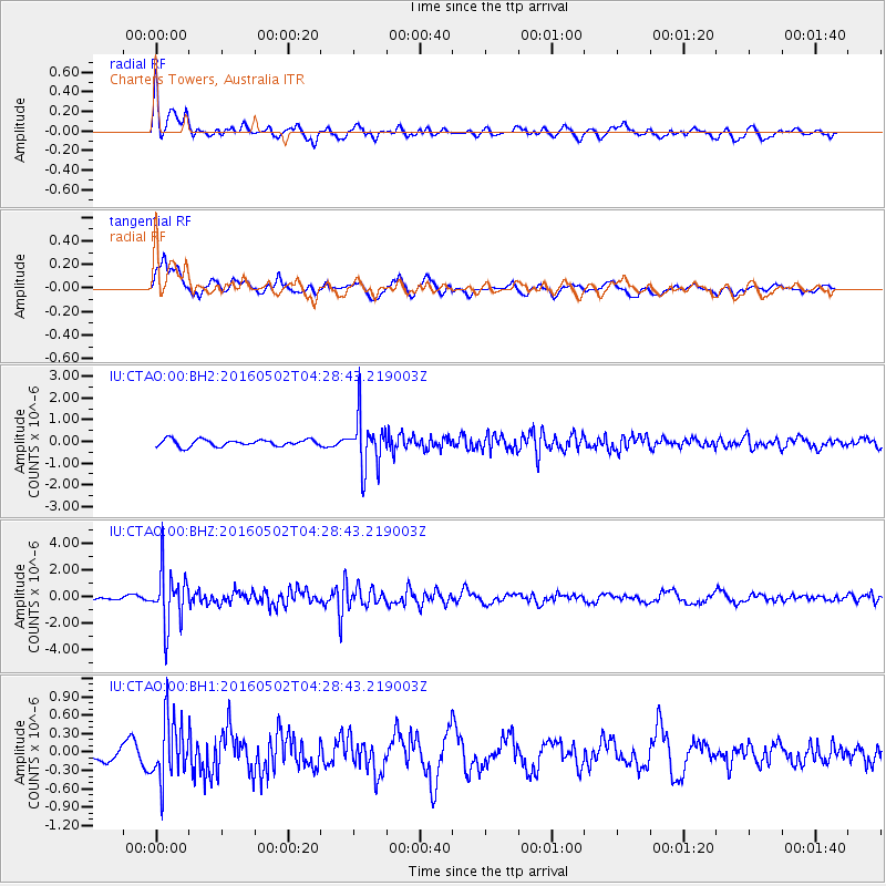
CTAO Charters Towers, Australia - Earthquake Result Viewer
*The percent match for this event was below the threshold and hence no stack was calculated.
| Earthquake location: |
Southern Sumatra, Indonesia |
| Earthquake latitude/longitude: |
-5.0/104.6 |
| Earthquake time(UTC): |
2016/05/02 (123) 04:21:24 GMT |
| Earthquake Depth: |
117 km |
| Earthquake Magnitude: |
5.7 MWW, 5.7 MWB, 5.7 MWC |
| Earthquake Catalog/Contributor: |
NEIC PDE/NEIC COMCAT |
|
| Network: |
IU Global Seismograph Network (GSN - IRIS/USGS) |
| Station: |
CTAO Charters Towers, Australia |
| Lat/Lon: |
20.09 S/146.25 E |
| Elevation: |
357 m |
|
| Distance: |
43.1 deg |
| Az: |
114.077 deg |
| Baz: |
284.606 deg |
| Ray Param: |
$rayparam |
*The percent match for this event was below the threshold and hence was not used in the summary stack. |
|
| Radial Match: |
74.91997 % |
| Radial Bump: |
400 |
| Transverse Match: |
69.44314 % |
| Transverse Bump: |
400 |
| SOD ConfigId: |
1475611 |
| Insert Time: |
2016-05-16 04:23:02.691 +0000 |
| GWidth: |
2.5 |
| Max Bumps: |
400 |
| Tol: |
0.001 |
|
Signal To Noise
| Channel | StoN | STA | LTA |
| IU:CTAO:00:BHZ:20160502T04:28:43.219003Z | 13.983722 | 2.0468012E-6 | 1.4637027E-7 |
| IU:CTAO:00:BH1:20160502T04:28:43.219003Z | 4.795343 | 4.936103E-7 | 1.0293535E-7 |
| IU:CTAO:00:BH2:20160502T04:28:43.219003Z | 7.466918 | 1.158111E-6 | 1.5509893E-7 |
| Arrivals |
| Ps | |
| PpPs | |
| PsPs/PpSs | |


