You are here: Home > Network List > TA - USArray Transportable Network (new EarthScope stations) Stations List
> Station C16K Lisburne Hills, AK, USA > Earthquake Result Viewer
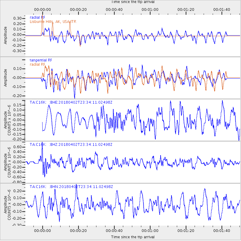
C16K Lisburne Hills, AK, USA - Earthquake Result Viewer
*The percent match for this event was below the threshold and hence no stack was calculated.
| Earthquake location: |
El Salvador |
| Earthquake latitude/longitude: |
13.1/-88.7 |
| Earthquake time(UTC): |
2018/04/02 (092) 23:23:17 GMT |
| Earthquake Depth: |
50 km |
| Earthquake Magnitude: |
5.9 Mww |
| Earthquake Catalog/Contributor: |
NEIC PDE/us |
|
| Network: |
TA USArray Transportable Network (new EarthScope stations) |
| Station: |
C16K Lisburne Hills, AK, USA |
| Lat/Lon: |
68.27 N/165.34 W |
| Elevation: |
102 m |
|
| Distance: |
73.0 deg |
| Az: |
337.736 deg |
| Baz: |
97.499 deg |
| Ray Param: |
$rayparam |
*The percent match for this event was below the threshold and hence was not used in the summary stack. |
|
| Radial Match: |
53.83275 % |
| Radial Bump: |
400 |
| Transverse Match: |
55.340744 % |
| Transverse Bump: |
400 |
| SOD ConfigId: |
13570011 |
| Insert Time: |
2019-04-30 01:41:50.966 +0000 |
| GWidth: |
2.5 |
| Max Bumps: |
400 |
| Tol: |
0.001 |
|
Signal To Noise
| Channel | StoN | STA | LTA |
| TA:C16K: :BHZ:20180402T23:34:11.02498Z | 4.7261825 | 3.0399224E-7 | 6.4320886E-8 |
| TA:C16K: :BHN:20180402T23:34:11.02498Z | 2.005117 | 1.1147336E-7 | 5.559444E-8 |
| TA:C16K: :BHE:20180402T23:34:11.02498Z | 1.0748763 | 8.1751764E-8 | 7.605691E-8 |
| Arrivals |
| Ps | |
| PpPs | |
| PsPs/PpSs | |


