You are here: Home > Network List > TA - USArray Transportable Network (new EarthScope stations) Stations List
> Station F20K Avaraart Lake, AK, USA > Earthquake Result Viewer
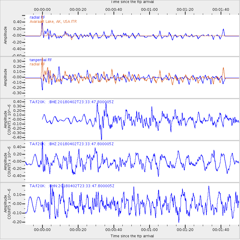
F20K Avaraart Lake, AK, USA - Earthquake Result Viewer
*The percent match for this event was below the threshold and hence no stack was calculated.
| Earthquake location: |
El Salvador |
| Earthquake latitude/longitude: |
13.1/-88.7 |
| Earthquake time(UTC): |
2018/04/02 (092) 23:23:17 GMT |
| Earthquake Depth: |
50 km |
| Earthquake Magnitude: |
5.9 Mww |
| Earthquake Catalog/Contributor: |
NEIC PDE/us |
|
| Network: |
TA USArray Transportable Network (new EarthScope stations) |
| Station: |
F20K Avaraart Lake, AK, USA |
| Lat/Lon: |
67.05 N/155.73 W |
| Elevation: |
136 m |
|
| Distance: |
69.1 deg |
| Az: |
337.265 deg |
| Baz: |
106.238 deg |
| Ray Param: |
$rayparam |
*The percent match for this event was below the threshold and hence was not used in the summary stack. |
|
| Radial Match: |
58.79585 % |
| Radial Bump: |
400 |
| Transverse Match: |
53.7499 % |
| Transverse Bump: |
400 |
| SOD ConfigId: |
13570011 |
| Insert Time: |
2019-04-30 01:42:11.056 +0000 |
| GWidth: |
2.5 |
| Max Bumps: |
400 |
| Tol: |
0.001 |
|
Signal To Noise
| Channel | StoN | STA | LTA |
| TA:F20K: :BHZ:20180402T23:33:47.800005Z | 2.123434 | 2.0076742E-7 | 9.4548454E-8 |
| TA:F20K: :BHN:20180402T23:33:47.800005Z | 1.1392244 | 6.9979706E-8 | 6.142749E-8 |
| TA:F20K: :BHE:20180402T23:33:47.800005Z | 3.749597 | 1.9163008E-7 | 5.1106845E-8 |
| Arrivals |
| Ps | |
| PpPs | |
| PsPs/PpSs | |


