You are here: Home > Network List > TA - USArray Transportable Network (new EarthScope stations) Stations List
> Station H16K Elim, AK, USA > Earthquake Result Viewer
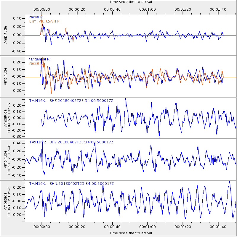
H16K Elim, AK, USA - Earthquake Result Viewer
*The percent match for this event was below the threshold and hence no stack was calculated.
| Earthquake location: |
El Salvador |
| Earthquake latitude/longitude: |
13.1/-88.7 |
| Earthquake time(UTC): |
2018/04/02 (092) 23:23:17 GMT |
| Earthquake Depth: |
50 km |
| Earthquake Magnitude: |
5.9 Mww |
| Earthquake Catalog/Contributor: |
NEIC PDE/us |
|
| Network: |
TA USArray Transportable Network (new EarthScope stations) |
| Station: |
H16K Elim, AK, USA |
| Lat/Lon: |
64.64 N/162.24 W |
| Elevation: |
216 m |
|
| Distance: |
71.2 deg |
| Az: |
334.13 deg |
| Baz: |
99.234 deg |
| Ray Param: |
$rayparam |
*The percent match for this event was below the threshold and hence was not used in the summary stack. |
|
| Radial Match: |
50.677956 % |
| Radial Bump: |
400 |
| Transverse Match: |
52.080673 % |
| Transverse Bump: |
400 |
| SOD ConfigId: |
13570011 |
| Insert Time: |
2019-04-30 01:42:24.381 +0000 |
| GWidth: |
2.5 |
| Max Bumps: |
400 |
| Tol: |
0.001 |
|
Signal To Noise
| Channel | StoN | STA | LTA |
| TA:H16K: :BHZ:20180402T23:34:00.500017Z | 2.5945845 | 1.9286074E-7 | 7.4332036E-8 |
| TA:H16K: :BHN:20180402T23:34:00.500017Z | 1.4179144 | 1.0465498E-7 | 7.38091E-8 |
| TA:H16K: :BHE:20180402T23:34:00.500017Z | 1.583384 | 9.333672E-8 | 5.8947624E-8 |
| Arrivals |
| Ps | |
| PpPs | |
| PsPs/PpSs | |


