You are here: Home > Network List > TA - USArray Transportable Network (new EarthScope stations) Stations List
> Station G31M Satah River, YT, CAN > Earthquake Result Viewer
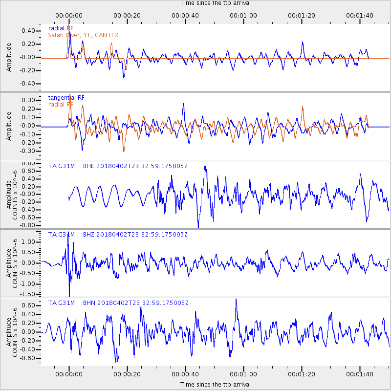
G31M Satah River, YT, CAN - Earthquake Result Viewer
*The percent match for this event was below the threshold and hence no stack was calculated.
| Earthquake location: |
El Salvador |
| Earthquake latitude/longitude: |
13.1/-88.7 |
| Earthquake time(UTC): |
2018/04/02 (092) 23:23:17 GMT |
| Earthquake Depth: |
50 km |
| Earthquake Magnitude: |
5.9 Mww |
| Earthquake Catalog/Contributor: |
NEIC PDE/us |
|
| Network: |
TA USArray Transportable Network (new EarthScope stations) |
| Station: |
G31M Satah River, YT, CAN |
| Lat/Lon: |
66.92 N/134.27 W |
| Elevation: |
61 m |
|
| Distance: |
61.6 deg |
| Az: |
341.328 deg |
| Baz: |
127.698 deg |
| Ray Param: |
$rayparam |
*The percent match for this event was below the threshold and hence was not used in the summary stack. |
|
| Radial Match: |
48.02852 % |
| Radial Bump: |
400 |
| Transverse Match: |
63.418743 % |
| Transverse Bump: |
400 |
| SOD ConfigId: |
13570011 |
| Insert Time: |
2019-04-30 01:42:24.761 +0000 |
| GWidth: |
2.5 |
| Max Bumps: |
400 |
| Tol: |
0.001 |
|
Signal To Noise
| Channel | StoN | STA | LTA |
| TA:G31M: :BHZ:20180402T23:32:59.175005Z | 5.116318 | 6.1890523E-7 | 1.2096692E-7 |
| TA:G31M: :BHN:20180402T23:32:59.175005Z | 1.3068153 | 2.4454923E-7 | 1.8713375E-7 |
| TA:G31M: :BHE:20180402T23:32:59.175005Z | 1.2603196 | 2.0696358E-7 | 1.6421515E-7 |
| Arrivals |
| Ps | |
| PpPs | |
| PsPs/PpSs | |


