You are here: Home > Network List > TA - USArray Transportable Network (new EarthScope stations) Stations List
> Station H31M Peel River, Yukon, CAN > Earthquake Result Viewer
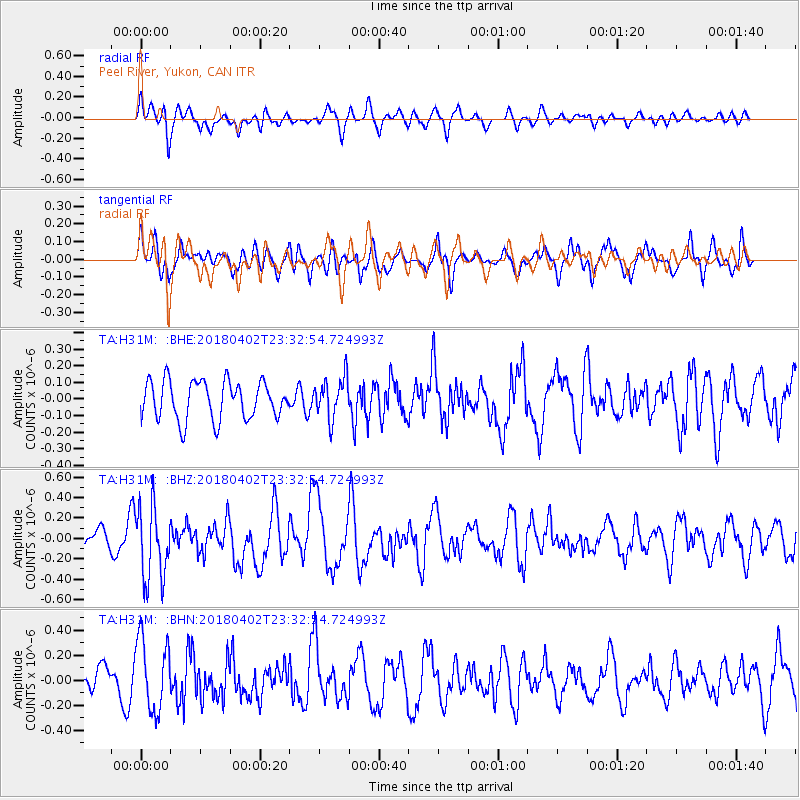
H31M Peel River, Yukon, CAN - Earthquake Result Viewer
*The percent match for this event was below the threshold and hence no stack was calculated.
| Earthquake location: |
El Salvador |
| Earthquake latitude/longitude: |
13.1/-88.7 |
| Earthquake time(UTC): |
2018/04/02 (092) 23:23:17 GMT |
| Earthquake Depth: |
50 km |
| Earthquake Magnitude: |
5.9 Mww |
| Earthquake Catalog/Contributor: |
NEIC PDE/us |
|
| Network: |
TA USArray Transportable Network (new EarthScope stations) |
| Station: |
H31M Peel River, Yukon, CAN |
| Lat/Lon: |
65.81 N/134.34 W |
| Elevation: |
642 m |
|
| Distance: |
60.9 deg |
| Az: |
340.291 deg |
| Baz: |
127.134 deg |
| Ray Param: |
$rayparam |
*The percent match for this event was below the threshold and hence was not used in the summary stack. |
|
| Radial Match: |
61.03555 % |
| Radial Bump: |
400 |
| Transverse Match: |
52.15625 % |
| Transverse Bump: |
400 |
| SOD ConfigId: |
13570011 |
| Insert Time: |
2019-04-30 01:42:30.537 +0000 |
| GWidth: |
2.5 |
| Max Bumps: |
400 |
| Tol: |
0.001 |
|
Signal To Noise
| Channel | StoN | STA | LTA |
| TA:H31M: :BHZ:20180402T23:32:54.724993Z | 4.113785 | 3.5774164E-7 | 8.696168E-8 |
| TA:H31M: :BHN:20180402T23:32:54.724993Z | 2.0593271 | 2.9137385E-7 | 1.4148983E-7 |
| TA:H31M: :BHE:20180402T23:32:54.724993Z | 1.0648472 | 1.220631E-7 | 1.1462967E-7 |
| Arrivals |
| Ps | |
| PpPs | |
| PsPs/PpSs | |


