You are here: Home > Network List > TA - USArray Transportable Network (new EarthScope stations) Stations List
> Station I17K Unalakleet, AK, USA > Earthquake Result Viewer
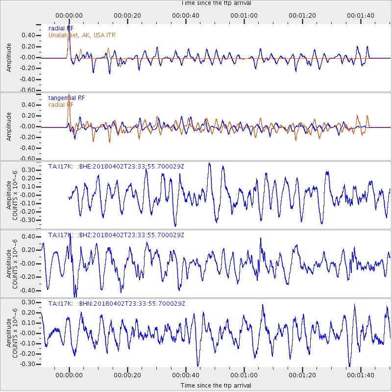
I17K Unalakleet, AK, USA - Earthquake Result Viewer
*The percent match for this event was below the threshold and hence no stack was calculated.
| Earthquake location: |
El Salvador |
| Earthquake latitude/longitude: |
13.1/-88.7 |
| Earthquake time(UTC): |
2018/04/02 (092) 23:23:17 GMT |
| Earthquake Depth: |
50 km |
| Earthquake Magnitude: |
5.9 Mww |
| Earthquake Catalog/Contributor: |
NEIC PDE/us |
|
| Network: |
TA USArray Transportable Network (new EarthScope stations) |
| Station: |
I17K Unalakleet, AK, USA |
| Lat/Lon: |
63.89 N/160.70 W |
| Elevation: |
105 m |
|
| Distance: |
70.4 deg |
| Az: |
333.465 deg |
| Baz: |
100.405 deg |
| Ray Param: |
$rayparam |
*The percent match for this event was below the threshold and hence was not used in the summary stack. |
|
| Radial Match: |
64.65096 % |
| Radial Bump: |
396 |
| Transverse Match: |
44.397358 % |
| Transverse Bump: |
400 |
| SOD ConfigId: |
13570011 |
| Insert Time: |
2019-04-30 01:42:31.160 +0000 |
| GWidth: |
2.5 |
| Max Bumps: |
400 |
| Tol: |
0.001 |
|
Signal To Noise
| Channel | StoN | STA | LTA |
| TA:I17K: :BHZ:20180402T23:33:55.700029Z | 2.280977 | 2.6231072E-7 | 1.14999274E-7 |
| TA:I17K: :BHN:20180402T23:33:55.700029Z | 1.338226 | 1.3809502E-7 | 1.031926E-7 |
| TA:I17K: :BHE:20180402T23:33:55.700029Z | 1.1325718 | 1.3220107E-7 | 1.1672644E-7 |
| Arrivals |
| Ps | |
| PpPs | |
| PsPs/PpSs | |


