You are here: Home > Network List > TA - USArray Transportable Network (new EarthScope stations) Stations List
> Station J20K Nowitna River, AK, USA > Earthquake Result Viewer
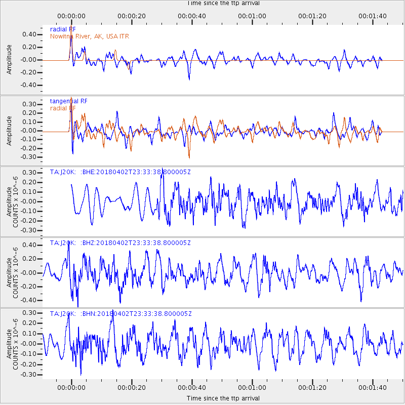
J20K Nowitna River, AK, USA - Earthquake Result Viewer
*The percent match for this event was below the threshold and hence no stack was calculated.
| Earthquake location: |
El Salvador |
| Earthquake latitude/longitude: |
13.1/-88.7 |
| Earthquake time(UTC): |
2018/04/02 (092) 23:23:17 GMT |
| Earthquake Depth: |
50 km |
| Earthquake Magnitude: |
5.9 Mww |
| Earthquake Catalog/Contributor: |
NEIC PDE/us |
|
| Network: |
TA USArray Transportable Network (new EarthScope stations) |
| Station: |
J20K Nowitna River, AK, USA |
| Lat/Lon: |
64.18 N/154.15 W |
| Elevation: |
314 m |
|
| Distance: |
67.7 deg |
| Az: |
334.489 deg |
| Baz: |
106.652 deg |
| Ray Param: |
$rayparam |
*The percent match for this event was below the threshold and hence was not used in the summary stack. |
|
| Radial Match: |
64.149796 % |
| Radial Bump: |
400 |
| Transverse Match: |
57.366108 % |
| Transverse Bump: |
400 |
| SOD ConfigId: |
13570011 |
| Insert Time: |
2019-04-30 01:42:40.319 +0000 |
| GWidth: |
2.5 |
| Max Bumps: |
400 |
| Tol: |
0.001 |
|
Signal To Noise
| Channel | StoN | STA | LTA |
| TA:J20K: :BHZ:20180402T23:33:38.800005Z | 3.5498605 | 2.3262469E-7 | 6.553066E-8 |
| TA:J20K: :BHN:20180402T23:33:38.800005Z | 1.3789281 | 1.2150211E-7 | 8.811345E-8 |
| TA:J20K: :BHE:20180402T23:33:38.800005Z | 1.7903986 | 1.8102382E-7 | 1.01108114E-7 |
| Arrivals |
| Ps | |
| PpPs | |
| PsPs/PpSs | |


