You are here: Home > Network List > CN - Canadian National Seismograph Network Stations List
> Station INK INUVIK, NT > Earthquake Result Viewer
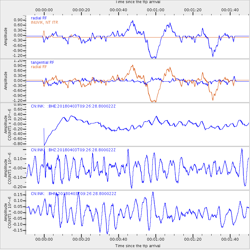
INK INUVIK, NT - Earthquake Result Viewer
*The percent match for this event was below the threshold and hence no stack was calculated.
| Earthquake location: |
North Of Halmahera, Indonesia |
| Earthquake latitude/longitude: |
3.0/128.0 |
| Earthquake time(UTC): |
2018/04/03 (093) 09:14:06 GMT |
| Earthquake Depth: |
72 km |
| Earthquake Magnitude: |
5.4 Mww |
| Earthquake Catalog/Contributor: |
NEIC PDE/us |
|
| Network: |
CN Canadian National Seismograph Network |
| Station: |
INK INUVIK, NT |
| Lat/Lon: |
68.31 N/133.53 W |
| Elevation: |
44 m |
|
| Distance: |
90.3 deg |
| Az: |
21.577 deg |
| Baz: |
278.961 deg |
| Ray Param: |
$rayparam |
*The percent match for this event was below the threshold and hence was not used in the summary stack. |
|
| Radial Match: |
14.107263 % |
| Radial Bump: |
400 |
| Transverse Match: |
32.550827 % |
| Transverse Bump: |
400 |
| SOD ConfigId: |
13570011 |
| Insert Time: |
2019-04-30 01:46:17.827 +0000 |
| GWidth: |
2.5 |
| Max Bumps: |
400 |
| Tol: |
0.001 |
|
Signal To Noise
| Channel | StoN | STA | LTA |
| CN:INK: :BHZ:20180403T09:26:28.800022Z | 1.0948033 | 7.776587E-8 | 7.103181E-8 |
| CN:INK: :BHN:20180403T09:26:28.800022Z | 1.2622434 | 1.1136775E-7 | 8.823001E-8 |
| CN:INK: :BHE:20180403T09:26:28.800022Z | 0.3432265 | 1.0537371E-7 | 3.0700923E-7 |
| Arrivals |
| Ps | |
| PpPs | |
| PsPs/PpSs | |


