You are here: Home > Network List > TJ - Tajikistan National Seismic Network Stations List
> Station GARM Garm, Tajikistan > Earthquake Result Viewer
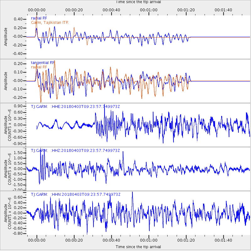
GARM Garm, Tajikistan - Earthquake Result Viewer
*The percent match for this event was below the threshold and hence no stack was calculated.
| Earthquake location: |
North Of Halmahera, Indonesia |
| Earthquake latitude/longitude: |
3.0/128.0 |
| Earthquake time(UTC): |
2018/04/03 (093) 09:14:06 GMT |
| Earthquake Depth: |
72 km |
| Earthquake Magnitude: |
5.4 Mww |
| Earthquake Catalog/Contributor: |
NEIC PDE/us |
|
| Network: |
TJ Tajikistan National Seismic Network |
| Station: |
GARM Garm, Tajikistan |
| Lat/Lon: |
39.00 N/70.32 E |
| Elevation: |
1305 m |
|
| Distance: |
63.3 deg |
| Az: |
312.527 deg |
| Baz: |
109.18 deg |
| Ray Param: |
$rayparam |
*The percent match for this event was below the threshold and hence was not used in the summary stack. |
|
| Radial Match: |
62.01024 % |
| Radial Bump: |
400 |
| Transverse Match: |
50.3097 % |
| Transverse Bump: |
400 |
| SOD ConfigId: |
13570011 |
| Insert Time: |
2019-04-30 01:49:19.565 +0000 |
| GWidth: |
2.5 |
| Max Bumps: |
400 |
| Tol: |
0.001 |
|
Signal To Noise
| Channel | StoN | STA | LTA |
| TJ:GARM: :HHZ:20180403T09:23:57.749973Z | 6.8584247 | 8.010941E-7 | 1.1680439E-7 |
| TJ:GARM: :HHN:20180403T09:23:57.749973Z | 1.0723335 | 1.6562879E-7 | 1.5445642E-7 |
| TJ:GARM: :HHE:20180403T09:23:57.749973Z | 2.3143694 | 2.5288693E-7 | 1.0926818E-7 |
| Arrivals |
| Ps | |
| PpPs | |
| PsPs/PpSs | |


