You are here: Home > Network List > TA - USArray Transportable Network (new EarthScope stations) Stations List
> Station G31M Satah River, YT, CAN > Earthquake Result Viewer
G31M Satah River, YT, CAN - Earthquake Result Viewer
*The percent match for this event was below the threshold and hence no stack was calculated.
| Earthquake location: |
Mindanao, Philippines |
| Earthquake latitude/longitude: |
6.8/126.8 |
| Earthquake time(UTC): |
2018/04/05 (095) 03:53:41 GMT |
| Earthquake Depth: |
64 km |
| Earthquake Magnitude: |
5.9 Mww |
| Earthquake Catalog/Contributor: |
NEIC PDE/us |
|
| Network: |
TA USArray Transportable Network (new EarthScope stations) |
| Station: |
G31M Satah River, YT, CAN |
| Lat/Lon: |
66.92 N/134.27 W |
| Elevation: |
61 m |
|
| Distance: |
87.3 deg |
| Az: |
22.945 deg |
| Baz: |
280.874 deg |
| Ray Param: |
$rayparam |
*The percent match for this event was below the threshold and hence was not used in the summary stack. |
|
| Radial Match: |
70.62577 % |
| Radial Bump: |
382 |
| Transverse Match: |
56.665176 % |
| Transverse Bump: |
382 |
| SOD ConfigId: |
13570011 |
| Insert Time: |
2019-04-30 01:54:22.907 +0000 |
| GWidth: |
2.5 |
| Max Bumps: |
400 |
| Tol: |
0.001 |
|
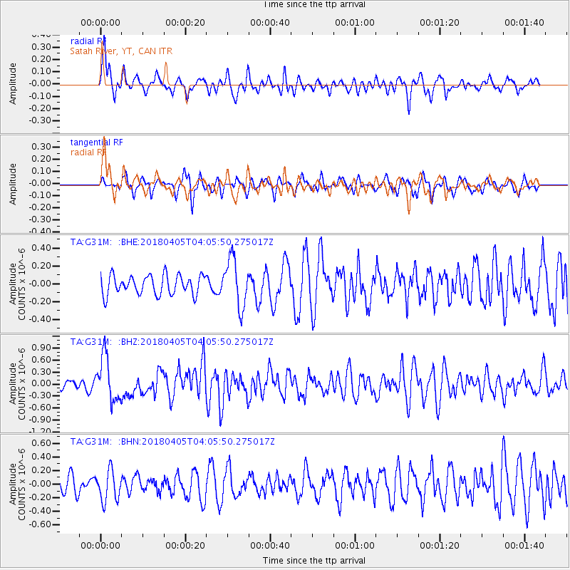
Signal To Noise
| Channel | StoN | STA | LTA |
| TA:G31M: :BHZ:20180405T04:05:50.275017Z | 3.6320438 | 5.710301E-7 | 1.5722004E-7 |
| TA:G31M: :BHN:20180405T04:05:50.275017Z | 1.4387115 | 2.2760808E-7 | 1.5820272E-7 |
| TA:G31M: :BHE:20180405T04:05:50.275017Z | 2.5612624 | 2.7787087E-7 | 1.08489814E-7 |
| Arrivals |
| Ps | |
| PpPs | |
| PsPs/PpSs | |


