You are here: Home > Network List > US - United States National Seismic Network Stations List
> Station EGMT Eagleton, Montana, USA > Earthquake Result Viewer
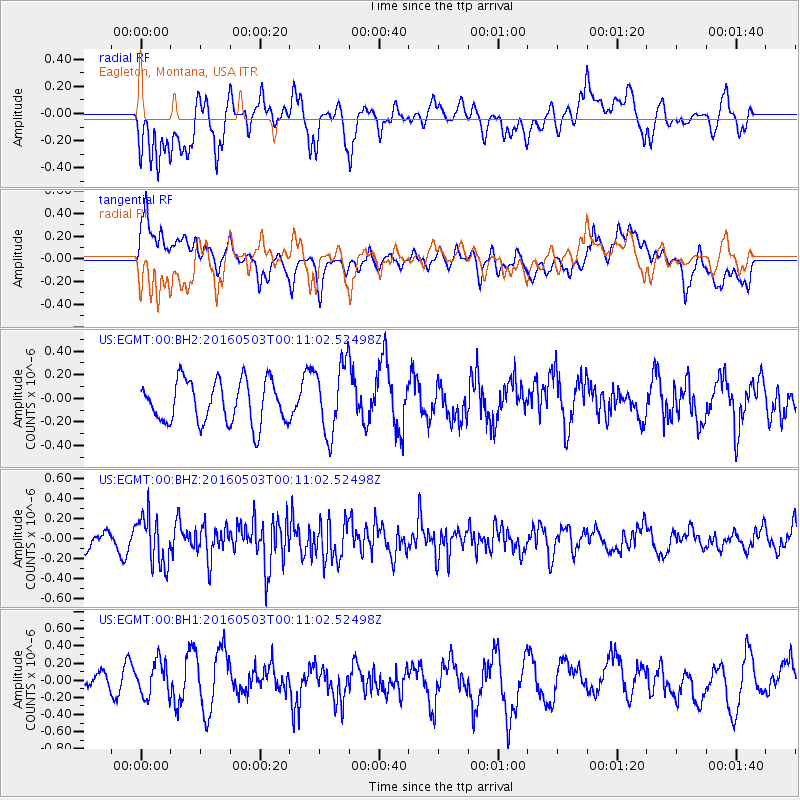
EGMT Eagleton, Montana, USA - Earthquake Result Viewer
*The percent match for this event was below the threshold and hence no stack was calculated.
| Earthquake location: |
Kuril Islands |
| Earthquake latitude/longitude: |
43.7/147.5 |
| Earthquake time(UTC): |
2016/05/03 (124) 00:00:51 GMT |
| Earthquake Depth: |
61 km |
| Earthquake Magnitude: |
5.5 MB, 5.7 MWC, 5.7 MWB |
| Earthquake Catalog/Contributor: |
NEIC PDE/NEIC COMCAT |
|
| Network: |
US United States National Seismic Network |
| Station: |
EGMT Eagleton, Montana, USA |
| Lat/Lon: |
48.02 N/109.75 W |
| Elevation: |
1055 m |
|
| Distance: |
66.2 deg |
| Az: |
45.674 deg |
| Baz: |
309.37 deg |
| Ray Param: |
$rayparam |
*The percent match for this event was below the threshold and hence was not used in the summary stack. |
|
| Radial Match: |
49.85141 % |
| Radial Bump: |
400 |
| Transverse Match: |
51.089424 % |
| Transverse Bump: |
400 |
| SOD ConfigId: |
1475611 |
| Insert Time: |
2016-05-17 00:10:18.990 +0000 |
| GWidth: |
2.5 |
| Max Bumps: |
400 |
| Tol: |
0.001 |
|
Signal To Noise
| Channel | StoN | STA | LTA |
| US:EGMT:00:BHZ:20160503T00:11:02.52498Z | 2.9042697 | 2.427616E-7 | 8.358782E-8 |
| US:EGMT:00:BH1:20160503T00:11:02.52498Z | 1.5868783 | 1.9857985E-7 | 1.2513868E-7 |
| US:EGMT:00:BH2:20160503T00:11:02.52498Z | 1.6503111 | 2.952123E-7 | 1.7888281E-7 |
| Arrivals |
| Ps | |
| PpPs | |
| PsPs/PpSs | |


