You are here: Home > Network List > IW - Intermountain West Stations List
> Station MOOW Moose Ponds, Wyoming, USA > Earthquake Result Viewer
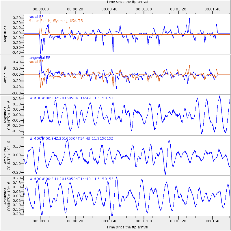
MOOW Moose Ponds, Wyoming, USA - Earthquake Result Viewer
*The percent match for this event was below the threshold and hence no stack was calculated.
| Earthquake location: |
Vanuatu Islands |
| Earthquake latitude/longitude: |
-14.9/166.9 |
| Earthquake time(UTC): |
2016/05/04 (125) 14:36:25 GMT |
| Earthquake Depth: |
35 km |
| Earthquake Magnitude: |
5.7 MO |
| Earthquake Catalog/Contributor: |
NEIC PDE/NEIC ALERT |
|
| Network: |
IW Intermountain West |
| Station: |
MOOW Moose Ponds, Wyoming, USA |
| Lat/Lon: |
43.75 N/110.74 W |
| Elevation: |
2128 m |
|
| Distance: |
94.8 deg |
| Az: |
46.116 deg |
| Baz: |
254.043 deg |
| Ray Param: |
$rayparam |
*The percent match for this event was below the threshold and hence was not used in the summary stack. |
|
| Radial Match: |
68.04136 % |
| Radial Bump: |
400 |
| Transverse Match: |
58.050747 % |
| Transverse Bump: |
376 |
| SOD ConfigId: |
1475611 |
| Insert Time: |
2016-05-18 14:40:21.672 +0000 |
| GWidth: |
2.5 |
| Max Bumps: |
400 |
| Tol: |
0.001 |
|
Signal To Noise
| Channel | StoN | STA | LTA |
| IW:MOOW:00:BHZ:20160504T14:49:11.515015Z | 2.2409835 | 1.3205634E-7 | 5.8927853E-8 |
| IW:MOOW:00:BH1:20160504T14:49:11.515015Z | 1.5741435 | 1.3161046E-7 | 8.360767E-8 |
| IW:MOOW:00:BH2:20160504T14:49:11.515015Z | 0.9540538 | 6.837325E-8 | 7.166602E-8 |
| Arrivals |
| Ps | |
| PpPs | |
| PsPs/PpSs | |


