You are here: Home > Network List > UW - Pacific Northwest Regional Seismic Network Stations List
> Station UMAT Pilot Rock, OR, USA > Earthquake Result Viewer
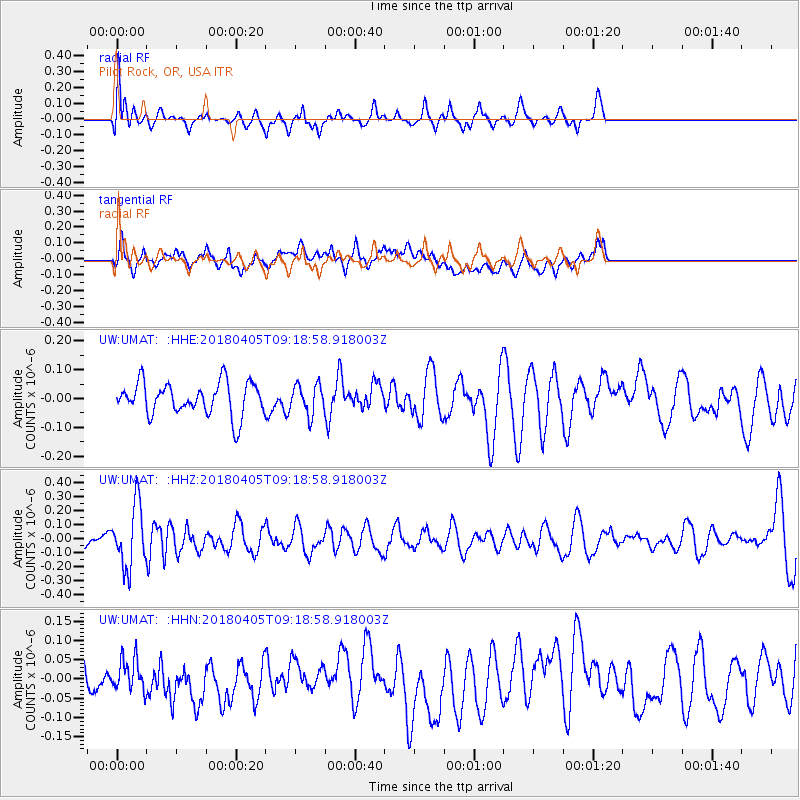
UMAT Pilot Rock, OR, USA - Earthquake Result Viewer
*The percent match for this event was below the threshold and hence no stack was calculated.
| Earthquake location: |
Fiji Islands Region |
| Earthquake latitude/longitude: |
-18.3/-177.9 |
| Earthquake time(UTC): |
2018/04/05 (095) 09:07:59 GMT |
| Earthquake Depth: |
507 km |
| Earthquake Magnitude: |
5.8 Mww |
| Earthquake Catalog/Contributor: |
NEIC PDE/us |
|
| Network: |
UW Pacific Northwest Regional Seismic Network |
| Station: |
UMAT Pilot Rock, OR, USA |
| Lat/Lon: |
45.29 N/118.96 W |
| Elevation: |
1318 m |
|
| Distance: |
82.8 deg |
| Az: |
37.546 deg |
| Baz: |
235.088 deg |
| Ray Param: |
$rayparam |
*The percent match for this event was below the threshold and hence was not used in the summary stack. |
|
| Radial Match: |
58.006794 % |
| Radial Bump: |
400 |
| Transverse Match: |
47.05327 % |
| Transverse Bump: |
400 |
| SOD ConfigId: |
13570011 |
| Insert Time: |
2019-04-30 02:03:02.992 +0000 |
| GWidth: |
2.5 |
| Max Bumps: |
400 |
| Tol: |
0.001 |
|
Signal To Noise
| Channel | StoN | STA | LTA |
| UW:UMAT: :HHZ:20180405T09:18:58.918003Z | 2.4212778 | 2.1858776E-7 | 9.0277844E-8 |
| UW:UMAT: :HHN:20180405T09:18:58.918003Z | 0.6112846 | 4.1232898E-8 | 6.7452866E-8 |
| UW:UMAT: :HHE:20180405T09:18:58.918003Z | 0.91643995 | 5.1301758E-8 | 5.5979402E-8 |
| Arrivals |
| Ps | |
| PpPs | |
| PsPs/PpSs | |


