P15A Leamington, UT, USA - Earthquake Result Viewer
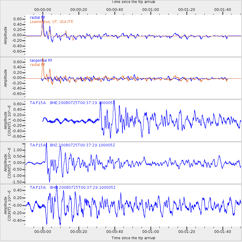
Earthquake location: Rat Islands, Aleutian Islands
Earthquake latitude/longitude: 51.3/179.0
Earthquake time(UTC): 2008/07/25 (207) 00:29:22 GMT
Earthquake Depth: 21 km
Earthquake Magnitude: 5.7 MB, 5.5 MS, 5.9 MW, 5.9 MW
Earthquake Catalog/Contributor: WHDF/NEIC
Network: TA USArray Transportable Network (new EarthScope stations)
Station: P15A Leamington, UT, USA
Lat/Lon: 39.57 N/112.28 W
Elevation: 1576 m
Distance: 48.0 deg
Az: 75.939 deg
Baz: 307.978 deg
Ray Param: 0.06963856
Estimated Moho Depth: 19.25 km
Estimated Crust Vp/Vs: 1.69
Assumed Crust Vp: 6.276 km/s
Estimated Crust Vs: 3.708 km/s
Estimated Crust Poisson's Ratio: 0.23
Radial Match: 94.06592 %
Radial Bump: 400
Transverse Match: 76.06044 %
Transverse Bump: 400
SOD ConfigId: 2504
Insert Time: 2010-03-06 10:25:50.034 +0000
GWidth: 2.5
Max Bumps: 400
Tol: 0.001

Signal To Noise

ChannelStoNSTALTA
TA:P15A: :BHZ:20080725T00:37:29.100005Z9.3727246.783938E-77.237958E-8
TA:P15A: :BHN:20080725T00:37:29.100005Z3.884371.9709543E-75.0740642E-8
TA:P15A: :BHE:20080725T00:37:29.100005Z6.4152432.9722045E-74.633035E-8
Arrivals
Ps2.3 SECOND
PpPs7.8 SECOND
PsPs/PpSs10 SECOND