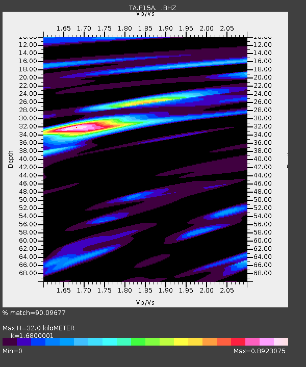
P15A Leamington, UT, USA - Earthquake Result Viewer
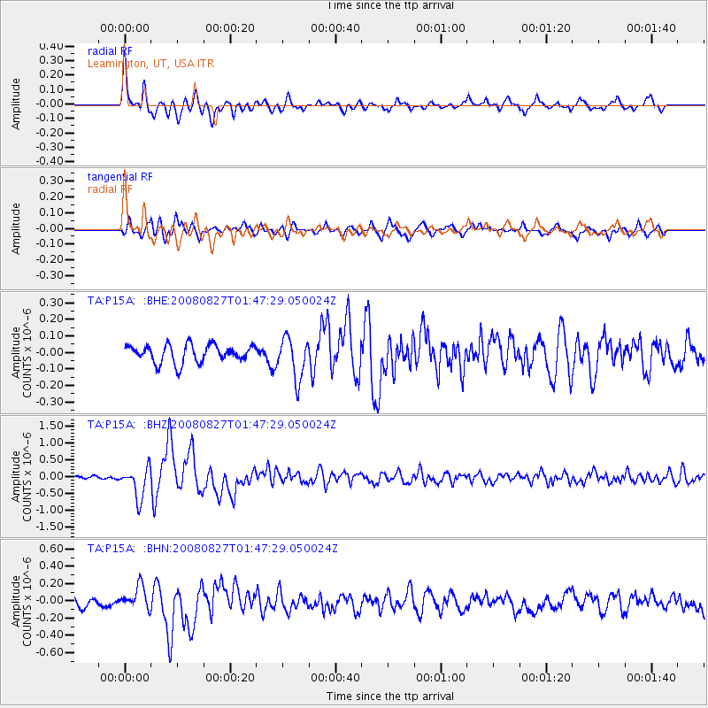
Earthquake location: Lake Baykal Region, Russia
Earthquake latitude/longitude: 51.6/104.2
Earthquake time(UTC): 2008/08/27 (240) 01:35:32 GMT
Earthquake Depth: 16 km
Earthquake Magnitude: 5.8 MB, 6.2 MS, 6.2 MW, 6.2 MW
Earthquake Catalog/Contributor: WHDF/NEIC
Network: TA USArray Transportable Network (new EarthScope stations)
Station: P15A Leamington, UT, USA
Lat/Lon: 39.57 N/112.28 W
Elevation: 1576 m
Distance: 83.8 deg
Az: 27.502 deg
Baz: 338.126 deg
Ray Param: 0.04592847
Estimated Moho Depth: 32.0 km
Estimated Crust Vp/Vs: 1.68
Assumed Crust Vp: 6.276 km/s
Estimated Crust Vs: 3.736 km/s
Estimated Crust Poisson's Ratio: 0.23
Radial Match: 90.09677 %
Radial Bump: 400
Transverse Match: 72.586266 %
Transverse Bump: 400
SOD ConfigId: 2504
Insert Time: 2010-03-06 10:26:01.110 +0000
GWidth: 2.5
Max Bumps: 400
Tol: 0.001

Signal To Noise

ChannelStoNSTALTA
TA:P15A: :BHZ:20080827T01:47:29.050024Z9.2042934.6546108E-75.0569994E-8
TA:P15A: :BHN:20080827T01:47:29.050024Z2.2811651.337463E-75.8630707E-8
TA:P15A: :BHE:20080827T01:47:29.050024Z2.32952981.2415259E-75.329513E-8
Arrivals
Ps3.6 SECOND
PpPs13 SECOND
PsPs/PpSs17 SECOND