
P15A Leamington, UT, USA - Earthquake Result Viewer
| ||||||||||||||||||
| ||||||||||||||||||
| ||||||||||||||||||
|
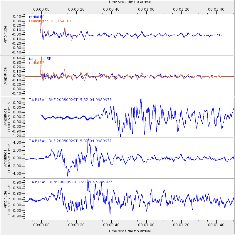
Signal To Noise
| Channel | StoN | STA | LTA |
| TA:P15A: :BHZ:20080929T15:32:04.998997Z | 3.6700227 | 3.724706E-7 | 1.01489995E-7 |
| TA:P15A: :BHN:20080929T15:32:04.998997Z | 1.3774341 | 8.7961936E-8 | 6.385927E-8 |
| TA:P15A: :BHE:20080929T15:32:04.998997Z | 2.0345724 | 9.9824284E-8 | 4.9064013E-8 |
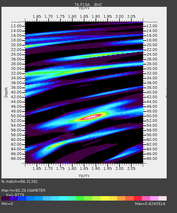
| Arrivals | |
| Ps | 7.2 SECOND |
| PpPs | 23 SECOND |
| PsPs/PpSs | 30 SECOND |

