You are here: Home > Network List > TA - USArray Transportable Network (new EarthScope stations) Stations List
> Station P15A Leamington, UT, USA > Earthquake Result Viewer
P15A Leamington, UT, USA - Earthquake Result Viewer

| Earthquake location: |
Near Coast Of Peru |
| Earthquake latitude/longitude: |
-14.3/-76.1 |
| Earthquake time(UTC): |
2007/08/16 (228) 05:16:56 GMT |
| Earthquake Depth: |
23 km |
| Earthquake Magnitude: |
5.8 MB, 6.1 MS, 6.3 MW, 6.2 ML |
| Earthquake Catalog/Contributor: |
WHDF/NEIC |
|
| Network: |
TA USArray Transportable Network (new EarthScope stations) |
| Station: |
P15A Leamington, UT, USA |
| Lat/Lon: |
39.57 N/112.28 W |
| Elevation: |
1576 m |
|
| Distance: |
63.3 deg |
| Az: |
329.306 deg |
| Baz: |
140.189 deg |
| Ray Param: |
0.059645105 |
| Estimated Moho Depth: |
32.0 km |
| Estimated Crust Vp/Vs: |
1.75 |
| Assumed Crust Vp: |
6.276 km/s |
| Estimated Crust Vs: |
3.581 km/s |
| Estimated Crust Poisson's Ratio: |
0.26 |
|
| Radial Match: |
91.67687 % |
| Radial Bump: |
394 |
| Transverse Match: |
67.52627 % |
| Transverse Bump: |
398 |
| SOD ConfigId: |
2564 |
| Insert Time: |
2010-03-06 10:26:51.303 +0000 |
| GWidth: |
2.5 |
| Max Bumps: |
400 |
| Tol: |
0.001 |
|
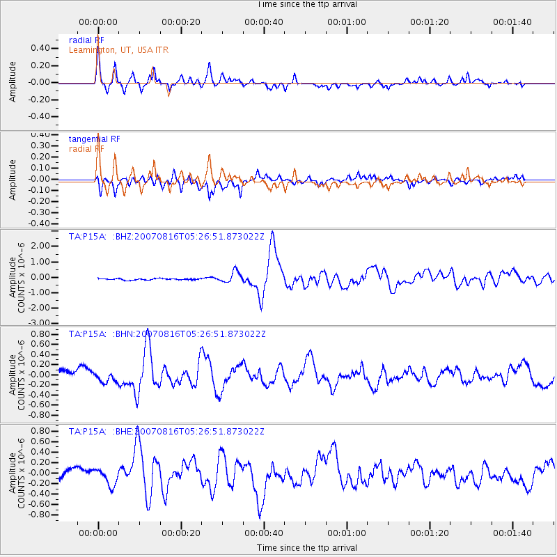
Signal To Noise
| Channel | StoN | STA | LTA |
| TA:P15A: :BHN:20070816T05:26:51.873022Z | 1.0420828 | 8.09599E-8 | 7.769047E-8 |
| TA:P15A: :BHE:20070816T05:26:51.873022Z | 1.3455583 | 1.5467081E-7 | 1.1494918E-7 |
| TA:P15A: :BHZ:20070816T05:26:51.873022Z | 8.186751 | 3.7411144E-7 | 4.5697178E-8 |
| Arrivals |
| Ps | 4.0 SECOND |
| PpPs | 13 SECOND |
| PsPs/PpSs | 17 SECOND |


