P15A Leamington, UT, USA - Earthquake Result Viewer
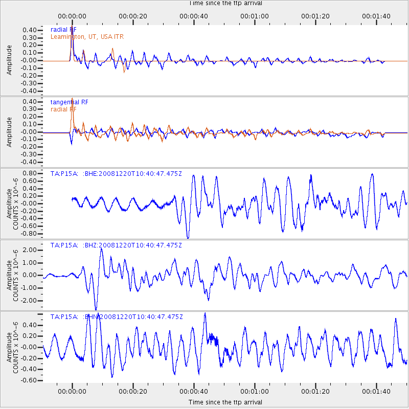
Earthquake location: Off East Coast Of Honshu, Japan
Earthquake latitude/longitude: 36.5/142.4
Earthquake time(UTC): 2008/12/20 (355) 10:29:23 GMT
Earthquake Depth: 19 km
Earthquake Magnitude: 6.0 MB, 6.3 MS, 6.3 MW, 6.3 MW
Earthquake Catalog/Contributor: WHDF/NEIC
Network: TA USArray Transportable Network (new EarthScope stations)
Station: P15A Leamington, UT, USA
Lat/Lon: 39.57 N/112.28 W
Elevation: 1576 m
Distance: 77.8 deg
Az: 49.719 deg
Baz: 307.358 deg
Ray Param: 0.05008296
Estimated Moho Depth: 58.25 km
Estimated Crust Vp/Vs: 1.64
Assumed Crust Vp: 6.276 km/s
Estimated Crust Vs: 3.833 km/s
Estimated Crust Poisson's Ratio: 0.20
Radial Match: 84.66934 %
Radial Bump: 372
Transverse Match: 58.44929 %
Transverse Bump: 400
SOD ConfigId: 2658
Insert Time: 2010-03-06 10:27:20.389 +0000
GWidth: 2.5
Max Bumps: 400
Tol: 0.001

Signal To Noise

ChannelStoNSTALTA
TA:P15A: :BHZ:20081220T10:40:47.475Z3.43211823.4281356E-79.988396E-8
TA:P15A: :BHN:20081220T10:40:47.475Z1.3365651.6914403E-71.2655129E-7
TA:P15A: :BHE:20081220T10:40:47.475Z1.0896291.2247114E-71.1239709E-7
Arrivals
Ps6.1 SECOND
PpPs24 SECOND
PsPs/PpSs30 SECOND