You are here: Home > Network List > TA - USArray Transportable Network (new EarthScope stations) Stations List
> Station I23K Minto, Yukon-Koyukuk, AK, USA > Earthquake Result Viewer
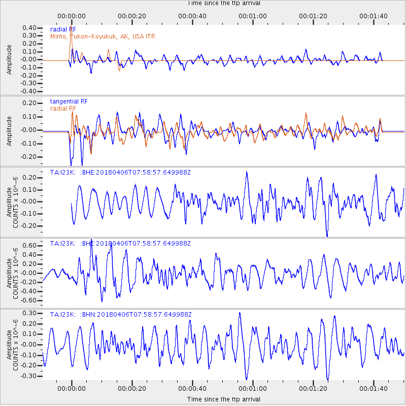
I23K Minto, Yukon-Koyukuk, AK, USA - Earthquake Result Viewer
*The percent match for this event was below the threshold and hence no stack was calculated.
| Earthquake location: |
Near North Coast Of Irian Jaya |
| Earthquake latitude/longitude: |
-1.5/138.2 |
| Earthquake time(UTC): |
2018/04/06 (096) 07:46:58 GMT |
| Earthquake Depth: |
10 km |
| Earthquake Magnitude: |
5.5 Mww |
| Earthquake Catalog/Contributor: |
NEIC PDE/us |
|
| Network: |
TA USArray Transportable Network (new EarthScope stations) |
| Station: |
I23K Minto, Yukon-Koyukuk, AK, USA |
| Lat/Lon: |
65.15 N/149.36 W |
| Elevation: |
149 m |
|
| Distance: |
84.0 deg |
| Az: |
23.902 deg |
| Baz: |
253.424 deg |
| Ray Param: |
$rayparam |
*The percent match for this event was below the threshold and hence was not used in the summary stack. |
|
| Radial Match: |
53.63367 % |
| Radial Bump: |
400 |
| Transverse Match: |
57.1842 % |
| Transverse Bump: |
400 |
| SOD ConfigId: |
13570011 |
| Insert Time: |
2019-04-30 02:14:16.965 +0000 |
| GWidth: |
2.5 |
| Max Bumps: |
400 |
| Tol: |
0.001 |
|
Signal To Noise
| Channel | StoN | STA | LTA |
| TA:I23K: :BHZ:20180406T07:58:57.649988Z | 2.6730673 | 1.8708687E-7 | 6.998958E-8 |
| TA:I23K: :BHN:20180406T07:58:57.649988Z | 1.6459248 | 1.286166E-7 | 7.8142456E-8 |
| TA:I23K: :BHE:20180406T07:58:57.649988Z | 0.97547984 | 8.3124284E-8 | 8.5213735E-8 |
| Arrivals |
| Ps | |
| PpPs | |
| PsPs/PpSs | |


