You are here: Home > Network List > TA - USArray Transportable Network (new EarthScope stations) Stations List
> Station P15A Leamington, UT, USA > Earthquake Result Viewer
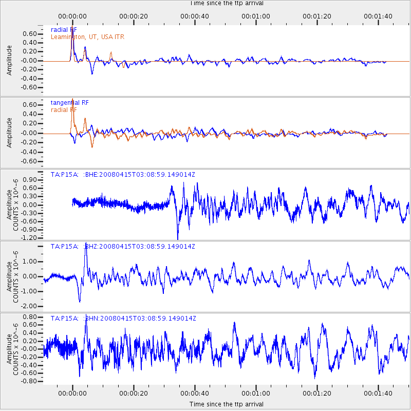
P15A Leamington, UT, USA - Earthquake Result Viewer
*The percent match for this event was below the threshold and hence no stack was calculated.
| Earthquake location: |
Near Coast Of Guatemala |
| Earthquake latitude/longitude: |
13.6/-90.6 |
| Earthquake time(UTC): |
2008/04/15 (106) 03:03:04 GMT |
| Earthquake Depth: |
33 km |
| Earthquake Magnitude: |
5.6 MB, 5.8 MS, 6.1 MW, 6.1 MW |
| Earthquake Catalog/Contributor: |
WHDF/NEIC |
|
| Network: |
TA USArray Transportable Network (new EarthScope stations) |
| Station: |
P15A Leamington, UT, USA |
| Lat/Lon: |
39.57 N/112.28 W |
| Elevation: |
1576 m |
|
| Distance: |
32.2 deg |
| Az: |
327.583 deg |
| Baz: |
137.587 deg |
| Ray Param: |
$rayparam |
*The percent match for this event was below the threshold and hence was not used in the summary stack. |
|
| Radial Match: |
78.872925 % |
| Radial Bump: |
371 |
| Transverse Match: |
71.21614 % |
| Transverse Bump: |
400 |
| SOD ConfigId: |
2504 |
| Insert Time: |
2010-03-06 10:27:59.200 +0000 |
| GWidth: |
2.5 |
| Max Bumps: |
400 |
| Tol: |
0.001 |
|
Signal To Noise
| Channel | StoN | STA | LTA |
| TA:P15A: :BHZ:20080415T03:08:59.149014Z | 6.092682 | 9.1892304E-7 | 1.5082406E-7 |
| TA:P15A: :BHN:20080415T03:08:59.149014Z | 2.5764344 | 3.0893557E-7 | 1.1990818E-7 |
| TA:P15A: :BHE:20080415T03:08:59.149014Z | 3.4335508 | 4.1462846E-7 | 1.2075793E-7 |
| Arrivals |
| Ps | |
| PpPs | |
| PsPs/PpSs | |


