You are here: Home > Network List > TA - USArray Transportable Network (new EarthScope stations) Stations List
> Station P15A Leamington, UT, USA > Earthquake Result Viewer
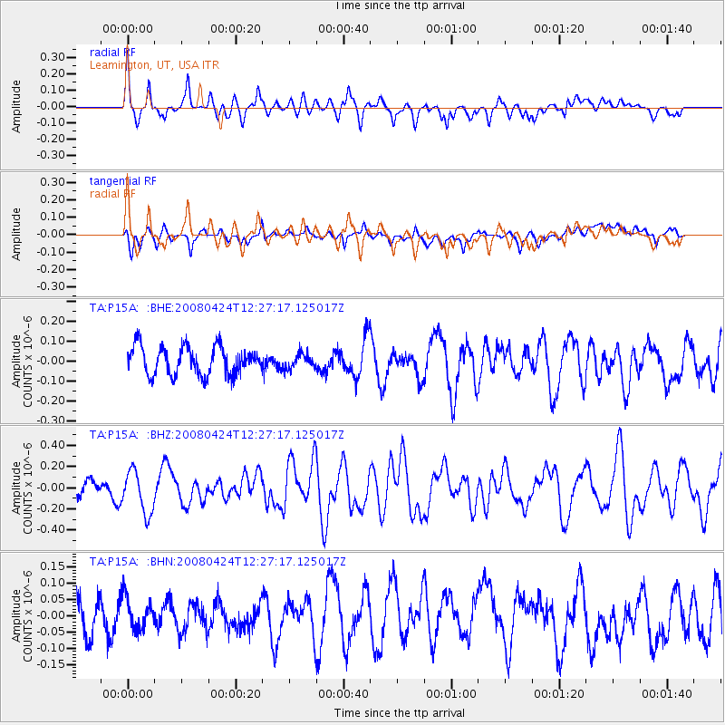
P15A Leamington, UT, USA - Earthquake Result Viewer
*The percent match for this event was below the threshold and hence no stack was calculated.
| Earthquake location: |
Central Mid-Atlantic Ridge |
| Earthquake latitude/longitude: |
-1.2/-23.5 |
| Earthquake time(UTC): |
2008/04/24 (115) 12:14:49 GMT |
| Earthquake Depth: |
10 km |
| Earthquake Magnitude: |
6.0 MS, 5.4 MB, 6.5 MW, 6.4 MW |
| Earthquake Catalog/Contributor: |
WHDF/NEIC |
|
| Network: |
TA USArray Transportable Network (new EarthScope stations) |
| Station: |
P15A Leamington, UT, USA |
| Lat/Lon: |
39.57 N/112.28 W |
| Elevation: |
1576 m |
|
| Distance: |
89.8 deg |
| Az: |
309.397 deg |
| Baz: |
91.664 deg |
| Ray Param: |
$rayparam |
*The percent match for this event was below the threshold and hence was not used in the summary stack. |
|
| Radial Match: |
68.615425 % |
| Radial Bump: |
400 |
| Transverse Match: |
56.153824 % |
| Transverse Bump: |
400 |
| SOD ConfigId: |
2504 |
| Insert Time: |
2010-03-06 10:28:03.593 +0000 |
| GWidth: |
2.5 |
| Max Bumps: |
400 |
| Tol: |
0.001 |
|
Signal To Noise
| Channel | StoN | STA | LTA |
| TA:P15A: :BHZ:20080424T12:27:17.125017Z | 4.059174 | 2.026993E-7 | 4.9936094E-8 |
| TA:P15A: :BHN:20080424T12:27:17.125017Z | 0.75074655 | 4.808757E-8 | 6.4053005E-8 |
| TA:P15A: :BHE:20080424T12:27:17.125017Z | 0.4834862 | 3.4076383E-8 | 7.048057E-8 |
| Arrivals |
| Ps | |
| PpPs | |
| PsPs/PpSs | |


