You are here: Home > Network List > TA - USArray Transportable Network (new EarthScope stations) Stations List
> Station P15A Leamington, UT, USA > Earthquake Result Viewer
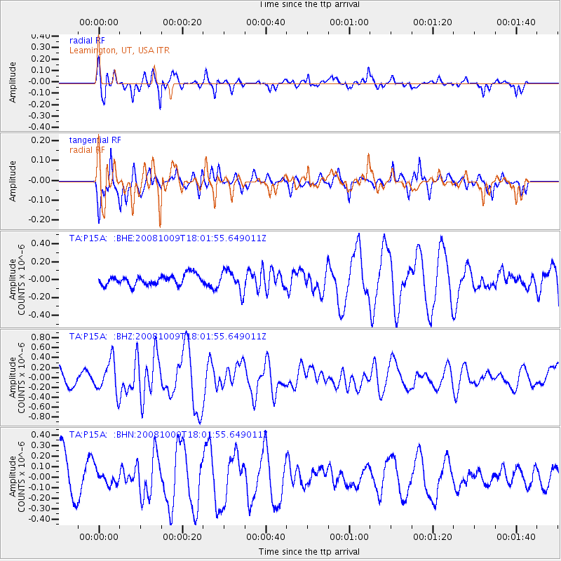
P15A Leamington, UT, USA - Earthquake Result Viewer
*The percent match for this event was below the threshold and hence no stack was calculated.
| Earthquake location: |
Tonga Islands |
| Earthquake latitude/longitude: |
-21.0/-174.4 |
| Earthquake time(UTC): |
2008/10/09 (283) 17:49:58 GMT |
| Earthquake Depth: |
10 km |
| Earthquake Magnitude: |
5.8 MB, 5.6 MS, 5.9 MW, 5.9 MW |
| Earthquake Catalog/Contributor: |
WHDF/NEIC |
|
| Network: |
TA USArray Transportable Network (new EarthScope stations) |
| Station: |
P15A Leamington, UT, USA |
| Lat/Lon: |
39.57 N/112.28 W |
| Elevation: |
1576 m |
|
| Distance: |
83.6 deg |
| Az: |
43.441 deg |
| Baz: |
236.208 deg |
| Ray Param: |
$rayparam |
*The percent match for this event was below the threshold and hence was not used in the summary stack. |
|
| Radial Match: |
62.750168 % |
| Radial Bump: |
304 |
| Transverse Match: |
57.797413 % |
| Transverse Bump: |
400 |
| SOD ConfigId: |
2560 |
| Insert Time: |
2010-03-06 10:28:24.085 +0000 |
| GWidth: |
2.5 |
| Max Bumps: |
400 |
| Tol: |
0.001 |
|
Signal To Noise
| Channel | StoN | STA | LTA |
| TA:P15A: :BHZ:20081009T18:01:55.649011Z | 2.0908465 | 3.38193E-7 | 1.6174933E-7 |
| TA:P15A: :BHN:20081009T18:01:55.649011Z | 0.2680271 | 6.034066E-8 | 2.2512897E-7 |
| TA:P15A: :BHE:20081009T18:01:55.649011Z | 2.1556687 | 1.2044613E-7 | 5.5874136E-8 |
| Arrivals |
| Ps | |
| PpPs | |
| PsPs/PpSs | |


