You are here: Home > Network List > TA - USArray Transportable Network (new EarthScope stations) Stations List
> Station F26K Sheenjek River, AK, USA > Earthquake Result Viewer
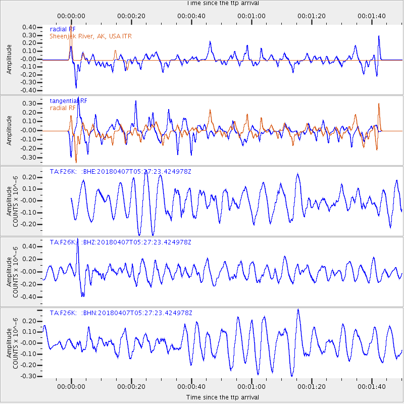
F26K Sheenjek River, AK, USA - Earthquake Result Viewer
*The percent match for this event was below the threshold and hence no stack was calculated.
| Earthquake location: |
New Britain Region, P.N.G. |
| Earthquake latitude/longitude: |
-5.5/152.0 |
| Earthquake time(UTC): |
2018/04/07 (097) 05:15:20 GMT |
| Earthquake Depth: |
35 km |
| Earthquake Magnitude: |
5.3 Mww |
| Earthquake Catalog/Contributor: |
NEIC PDE/us |
|
| Network: |
TA USArray Transportable Network (new EarthScope stations) |
| Station: |
F26K Sheenjek River, AK, USA |
| Lat/Lon: |
67.69 N/144.15 W |
| Elevation: |
683 m |
|
| Distance: |
85.5 deg |
| Az: |
20.109 deg |
| Baz: |
243.71 deg |
| Ray Param: |
$rayparam |
*The percent match for this event was below the threshold and hence was not used in the summary stack. |
|
| Radial Match: |
38.209667 % |
| Radial Bump: |
400 |
| Transverse Match: |
62.11011 % |
| Transverse Bump: |
373 |
| SOD ConfigId: |
13570011 |
| Insert Time: |
2019-04-30 02:23:19.603 +0000 |
| GWidth: |
2.5 |
| Max Bumps: |
400 |
| Tol: |
0.001 |
|
Signal To Noise
| Channel | StoN | STA | LTA |
| TA:F26K: :BHZ:20180407T05:27:23.424978Z | 3.0117185 | 2.3364666E-7 | 7.757918E-8 |
| TA:F26K: :BHN:20180407T05:27:23.424978Z | 0.27967507 | 3.5783586E-8 | 1.27947E-7 |
| TA:F26K: :BHE:20180407T05:27:23.424978Z | 1.0878304 | 1.3197352E-7 | 1.2131811E-7 |
| Arrivals |
| Ps | |
| PpPs | |
| PsPs/PpSs | |


