You are here: Home > Network List > TA - USArray Transportable Network (new EarthScope stations) Stations List
> Station I30M Mount Dempster, Yukon, CAN > Earthquake Result Viewer
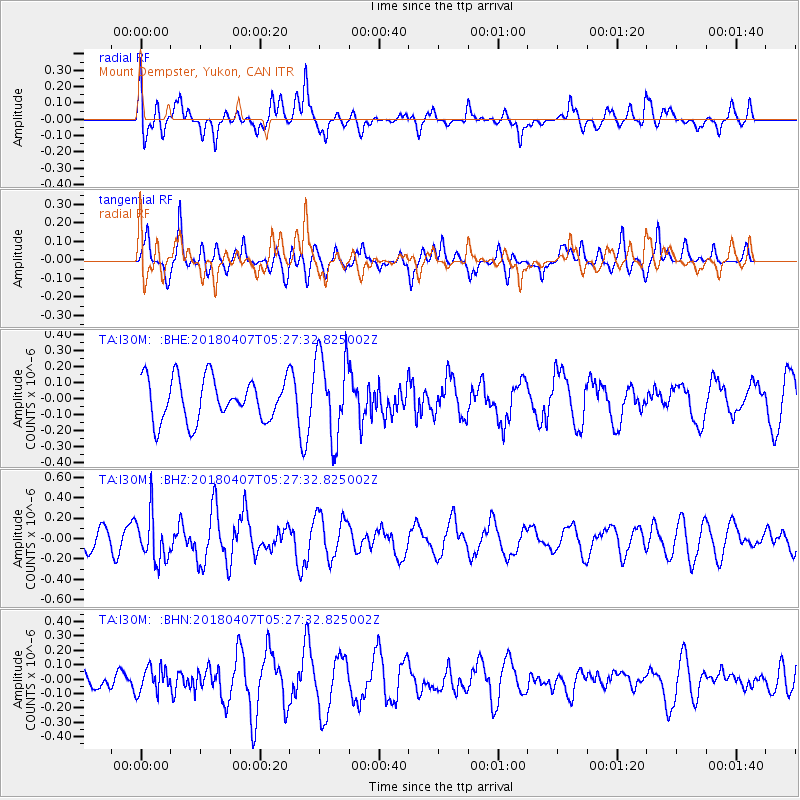
I30M Mount Dempster, Yukon, CAN - Earthquake Result Viewer
*The percent match for this event was below the threshold and hence no stack was calculated.
| Earthquake location: |
New Britain Region, P.N.G. |
| Earthquake latitude/longitude: |
-5.5/152.0 |
| Earthquake time(UTC): |
2018/04/07 (097) 05:15:20 GMT |
| Earthquake Depth: |
35 km |
| Earthquake Magnitude: |
5.3 Mww |
| Earthquake Catalog/Contributor: |
NEIC PDE/us |
|
| Network: |
TA USArray Transportable Network (new EarthScope stations) |
| Station: |
I30M Mount Dempster, Yukon, CAN |
| Lat/Lon: |
65.22 N/136.38 W |
| Elevation: |
1399 m |
|
| Distance: |
87.4 deg |
| Az: |
23.603 deg |
| Baz: |
251.046 deg |
| Ray Param: |
$rayparam |
*The percent match for this event was below the threshold and hence was not used in the summary stack. |
|
| Radial Match: |
46.2997 % |
| Radial Bump: |
400 |
| Transverse Match: |
65.74644 % |
| Transverse Bump: |
400 |
| SOD ConfigId: |
13570011 |
| Insert Time: |
2019-04-30 02:23:38.380 +0000 |
| GWidth: |
2.5 |
| Max Bumps: |
400 |
| Tol: |
0.001 |
|
Signal To Noise
| Channel | StoN | STA | LTA |
| TA:I30M: :BHZ:20180407T05:27:32.825002Z | 1.6839058 | 2.2870735E-7 | 1.3581955E-7 |
| TA:I30M: :BHN:20180407T05:27:32.825002Z | 0.93125844 | 8.751412E-8 | 9.397404E-8 |
| TA:I30M: :BHE:20180407T05:27:32.825002Z | 1.9987711 | 2.618493E-7 | 1.3100515E-7 |
| Arrivals |
| Ps | |
| PpPs | |
| PsPs/PpSs | |


