You are here: Home > Network List > TA - USArray Transportable Network (new EarthScope stations) Stations List
> Station P15A Leamington, UT, USA > Earthquake Result Viewer
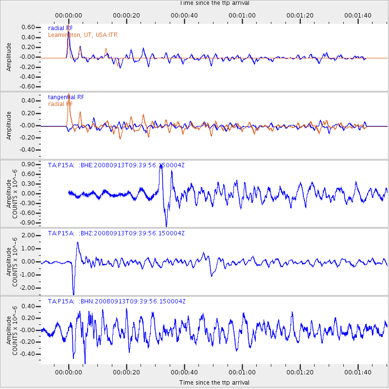
P15A Leamington, UT, USA - Earthquake Result Viewer
*The percent match for this event was below the threshold and hence no stack was calculated.
| Earthquake location: |
Colombia |
| Earthquake latitude/longitude: |
4.8/-75.5 |
| Earthquake time(UTC): |
2008/09/13 (257) 09:32:01 GMT |
| Earthquake Depth: |
133 km |
| Earthquake Magnitude: |
5.9 MB, 5.7 MW, 5.7 MW |
| Earthquake Catalog/Contributor: |
WHDF/NEIC |
|
| Network: |
TA USArray Transportable Network (new EarthScope stations) |
| Station: |
P15A Leamington, UT, USA |
| Lat/Lon: |
39.57 N/112.28 W |
| Elevation: |
1576 m |
|
| Distance: |
48.0 deg |
| Az: |
321.47 deg |
| Baz: |
126.569 deg |
| Ray Param: |
$rayparam |
*The percent match for this event was below the threshold and hence was not used in the summary stack. |
|
| Radial Match: |
75.8401 % |
| Radial Bump: |
354 |
| Transverse Match: |
66.768585 % |
| Transverse Bump: |
400 |
| SOD ConfigId: |
2504 |
| Insert Time: |
2010-03-06 10:28:34.597 +0000 |
| GWidth: |
2.5 |
| Max Bumps: |
400 |
| Tol: |
0.001 |
|
Signal To Noise
| Channel | StoN | STA | LTA |
| TA:P15A: :BHZ:20080913T09:39:56.150004Z | 12.7891655 | 9.655571E-7 | 7.549804E-8 |
| TA:P15A: :BHN:20080913T09:39:56.150004Z | 3.0495741 | 2.0176317E-7 | 6.616109E-8 |
| TA:P15A: :BHE:20080913T09:39:56.150004Z | 8.482098 | 5.2224874E-7 | 6.15707E-8 |
| Arrivals |
| Ps | |
| PpPs | |
| PsPs/PpSs | |


