You are here: Home > Network List > TA - USArray Transportable Network (new EarthScope stations) Stations List
> Station P15A Leamington, UT, USA > Earthquake Result Viewer
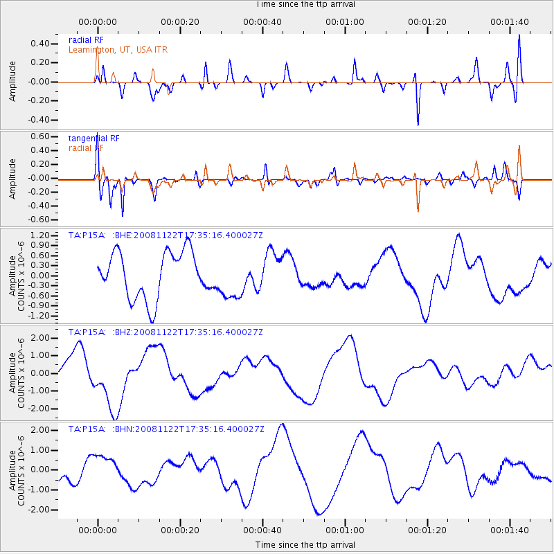
P15A Leamington, UT, USA - Earthquake Result Viewer
*The percent match for this event was below the threshold and hence no stack was calculated.
| Earthquake location: |
Southeast Of Loyalty Islands |
| Earthquake latitude/longitude: |
-22.4/171.2 |
| Earthquake time(UTC): |
2008/11/22 (327) 17:22:36 GMT |
| Earthquake Depth: |
69 km |
| Earthquake Magnitude: |
5.5 MB |
| Earthquake Catalog/Contributor: |
WHDF/NEIC |
|
| Network: |
TA USArray Transportable Network (new EarthScope stations) |
| Station: |
P15A Leamington, UT, USA |
| Lat/Lon: |
39.57 N/112.28 W |
| Elevation: |
1576 m |
|
| Distance: |
94.2 deg |
| Az: |
48.901 deg |
| Baz: |
244.422 deg |
| Ray Param: |
$rayparam |
*The percent match for this event was below the threshold and hence was not used in the summary stack. |
|
| Radial Match: |
61.228146 % |
| Radial Bump: |
400 |
| Transverse Match: |
87.939606 % |
| Transverse Bump: |
400 |
| SOD ConfigId: |
2658 |
| Insert Time: |
2010-03-06 10:28:43.409 +0000 |
| GWidth: |
2.5 |
| Max Bumps: |
400 |
| Tol: |
0.001 |
|
Signal To Noise
| Channel | StoN | STA | LTA |
| TA:P15A: :BHZ:20081122T17:35:16.400027Z | 1.9459468 | 1.5662476E-6 | 8.048769E-7 |
| TA:P15A: :BHN:20081122T17:35:16.400027Z | 1.6852534 | 8.109086E-7 | 4.8117903E-7 |
| TA:P15A: :BHE:20081122T17:35:16.400027Z | 0.95313424 | 6.746558E-7 | 7.078287E-7 |
| Arrivals |
| Ps | |
| PpPs | |
| PsPs/PpSs | |


