You are here: Home > Network List > TA - USArray Transportable Network (new EarthScope stations) Stations List
> Station P15A Leamington, UT, USA > Earthquake Result Viewer
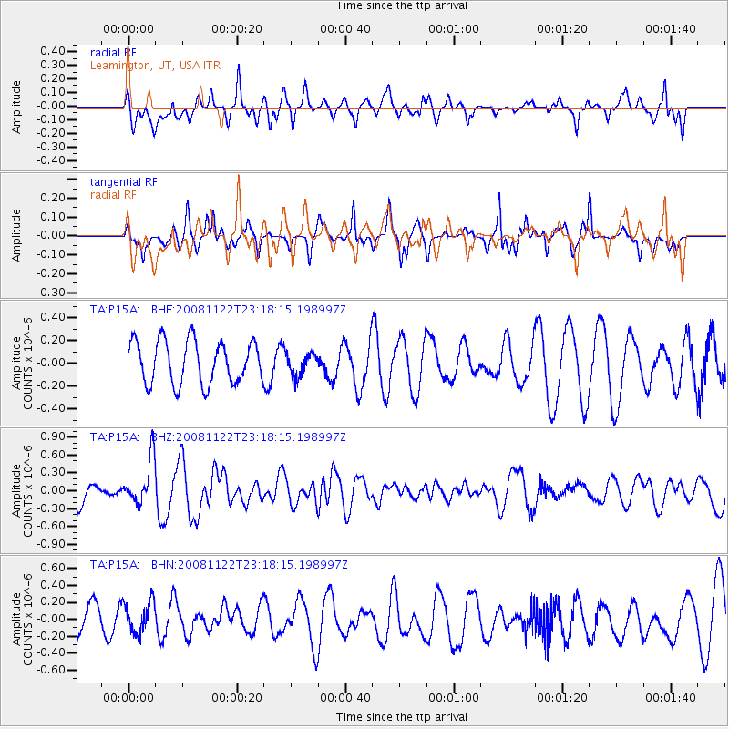
P15A Leamington, UT, USA - Earthquake Result Viewer
*The percent match for this event was below the threshold and hence no stack was calculated.
| Earthquake location: |
Southeast Of Easter Island |
| Earthquake latitude/longitude: |
-37.2/-95.1 |
| Earthquake time(UTC): |
2008/11/22 (327) 23:06:47 GMT |
| Earthquake Depth: |
10 km |
| Earthquake Magnitude: |
5.6 MB, 5.3 MS, 5.7 MW, 5.7 MW |
| Earthquake Catalog/Contributor: |
WHDF/NEIC |
|
| Network: |
TA USArray Transportable Network (new EarthScope stations) |
| Station: |
P15A Leamington, UT, USA |
| Lat/Lon: |
39.57 N/112.28 W |
| Elevation: |
1576 m |
|
| Distance: |
78.1 deg |
| Az: |
346.48 deg |
| Baz: |
166.032 deg |
| Ray Param: |
$rayparam |
*The percent match for this event was below the threshold and hence was not used in the summary stack. |
|
| Radial Match: |
56.872967 % |
| Radial Bump: |
400 |
| Transverse Match: |
65.3186 % |
| Transverse Bump: |
340 |
| SOD ConfigId: |
2658 |
| Insert Time: |
2010-03-06 10:28:44.153 +0000 |
| GWidth: |
2.5 |
| Max Bumps: |
400 |
| Tol: |
0.001 |
|
Signal To Noise
| Channel | StoN | STA | LTA |
| TA:P15A: :BHZ:20081122T23:18:15.198997Z | 1.9527674 | 3.8132933E-7 | 1.9527637E-7 |
| TA:P15A: :BHN:20081122T23:18:15.198997Z | 1.1672359 | 1.8109696E-7 | 1.5515027E-7 |
| TA:P15A: :BHE:20081122T23:18:15.198997Z | 0.5287262 | 9.880099E-8 | 1.8686606E-7 |
| Arrivals |
| Ps | |
| PpPs | |
| PsPs/PpSs | |


