You are here: Home > Network List > TA - USArray Transportable Network (new EarthScope stations) Stations List
> Station P15A Leamington, UT, USA > Earthquake Result Viewer
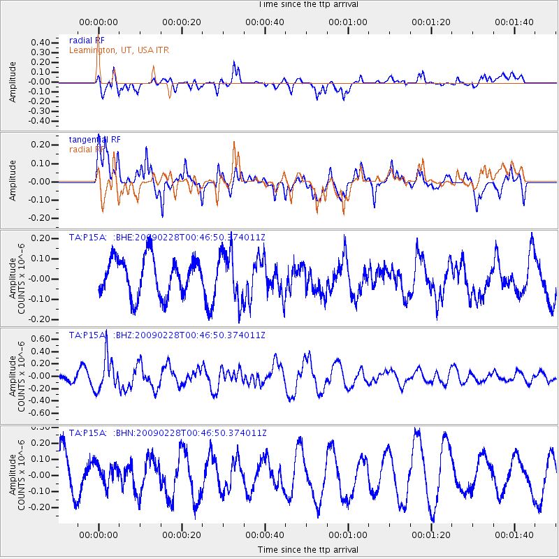
P15A Leamington, UT, USA - Earthquake Result Viewer
*The percent match for this event was below the threshold and hence no stack was calculated.
| Earthquake location: |
Hokkaido, Japan Region |
| Earthquake latitude/longitude: |
42.6/142.1 |
| Earthquake time(UTC): |
2009/02/28 (059) 00:35:56 GMT |
| Earthquake Depth: |
105 km |
| Earthquake Magnitude: |
5.5 MB, 5.5 MW, 5.5 MW |
| Earthquake Catalog/Contributor: |
WHDF/NEIC |
|
| Network: |
TA USArray Transportable Network (new EarthScope stations) |
| Station: |
P15A Leamington, UT, USA |
| Lat/Lon: |
39.57 N/112.28 W |
| Elevation: |
1576 m |
|
| Distance: |
74.1 deg |
| Az: |
50.724 deg |
| Baz: |
312.323 deg |
| Ray Param: |
$rayparam |
*The percent match for this event was below the threshold and hence was not used in the summary stack. |
|
| Radial Match: |
47.25442 % |
| Radial Bump: |
400 |
| Transverse Match: |
64.164154 % |
| Transverse Bump: |
400 |
| SOD ConfigId: |
2658 |
| Insert Time: |
2010-03-06 10:28:46.328 +0000 |
| GWidth: |
2.5 |
| Max Bumps: |
400 |
| Tol: |
0.001 |
|
Signal To Noise
| Channel | StoN | STA | LTA |
| TA:P15A: :BHZ:20090228T00:46:50.374011Z | 2.8962717 | 2.7432426E-7 | 9.471634E-8 |
| TA:P15A: :BHN:20090228T00:46:50.374011Z | 0.60321414 | 7.5880365E-8 | 1.257934E-7 |
| TA:P15A: :BHE:20090228T00:46:50.374011Z | 1.286827 | 1.1945254E-7 | 9.282719E-8 |
| Arrivals |
| Ps | |
| PpPs | |
| PsPs/PpSs | |


