You are here: Home > Network List > TA - USArray Transportable Network (new EarthScope stations) Stations List
> Station P15A Leamington, UT, USA > Earthquake Result Viewer
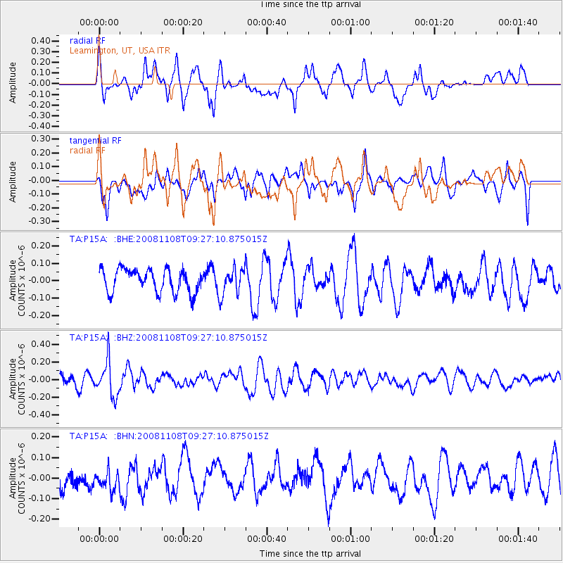
P15A Leamington, UT, USA - Earthquake Result Viewer
*The percent match for this event was below the threshold and hence no stack was calculated.
| Earthquake location: |
Tonga Islands |
| Earthquake latitude/longitude: |
-15.2/-174.2 |
| Earthquake time(UTC): |
2008/11/08 (313) 09:15:51 GMT |
| Earthquake Depth: |
140 km |
| Earthquake Magnitude: |
5.5 MW, 5.3 MB |
| Earthquake Catalog/Contributor: |
WHDF/NEIC |
|
| Network: |
TA USArray Transportable Network (new EarthScope stations) |
| Station: |
P15A Leamington, UT, USA |
| Lat/Lon: |
39.57 N/112.28 W |
| Elevation: |
1576 m |
|
| Distance: |
79.3 deg |
| Az: |
43.955 deg |
| Baz: |
240.1 deg |
| Ray Param: |
$rayparam |
*The percent match for this event was below the threshold and hence was not used in the summary stack. |
|
| Radial Match: |
58.540546 % |
| Radial Bump: |
400 |
| Transverse Match: |
56.564854 % |
| Transverse Bump: |
400 |
| SOD ConfigId: |
2658 |
| Insert Time: |
2010-03-06 10:29:20.500 +0000 |
| GWidth: |
2.5 |
| Max Bumps: |
400 |
| Tol: |
0.001 |
|
Signal To Noise
| Channel | StoN | STA | LTA |
| TA:P15A: :BHZ:20081108T09:27:10.875015Z | 3.1092527 | 2.052912E-7 | 6.60259E-8 |
| TA:P15A: :BHN:20081108T09:27:10.875015Z | 1.2143 | 6.140372E-8 | 5.056717E-8 |
| TA:P15A: :BHE:20081108T09:27:10.875015Z | 1.0526161 | 6.943607E-8 | 6.596524E-8 |
| Arrivals |
| Ps | |
| PpPs | |
| PsPs/PpSs | |


