You are here: Home > Network List > TA - USArray Transportable Network (new EarthScope stations) Stations List
> Station P15A Leamington, UT, USA > Earthquake Result Viewer
P15A Leamington, UT, USA - Earthquake Result Viewer
*The percent match for this event was below the threshold and hence no stack was calculated.
| Earthquake location: |
Mariana Islands Region |
| Earthquake latitude/longitude: |
15.9/144.9 |
| Earthquake time(UTC): |
2008/04/17 (108) 17:02:52 GMT |
| Earthquake Depth: |
10 km |
| Earthquake Magnitude: |
5.5 MB, 5.2 MS, 5.5 MW, 5.5 MW |
| Earthquake Catalog/Contributor: |
WHDF/NEIC |
|
| Network: |
TA USArray Transportable Network (new EarthScope stations) |
| Station: |
P15A Leamington, UT, USA |
| Lat/Lon: |
39.57 N/112.28 W |
| Elevation: |
1576 m |
|
| Distance: |
89.6 deg |
| Az: |
48.905 deg |
| Baz: |
290.241 deg |
| Ray Param: |
$rayparam |
*The percent match for this event was below the threshold and hence was not used in the summary stack. |
|
| Radial Match: |
46.12858 % |
| Radial Bump: |
400 |
| Transverse Match: |
68.49209 % |
| Transverse Bump: |
400 |
| SOD ConfigId: |
2504 |
| Insert Time: |
2010-03-06 10:29:25.001 +0000 |
| GWidth: |
2.5 |
| Max Bumps: |
400 |
| Tol: |
0.001 |
|
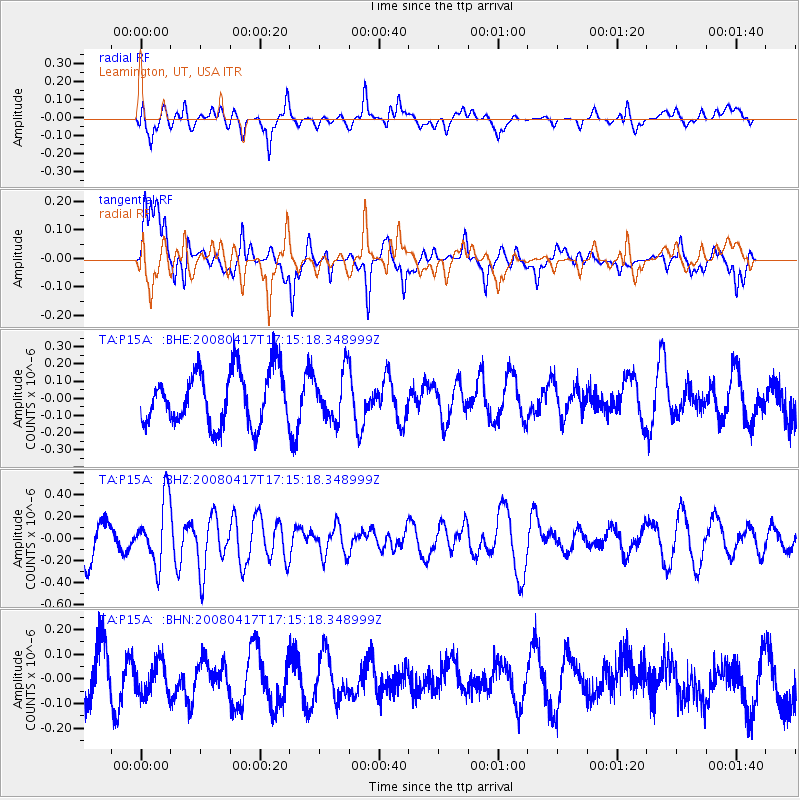
Signal To Noise
| Channel | StoN | STA | LTA |
| TA:P15A: :BHZ:20080417T17:15:18.348999Z | 2.030533 | 2.845331E-7 | 1.4012727E-7 |
| TA:P15A: :BHN:20080417T17:15:18.348999Z | 0.65342927 | 6.596688E-8 | 1.0095489E-7 |
| TA:P15A: :BHE:20080417T17:15:18.348999Z | 0.90625507 | 1.4050264E-7 | 1.5503653E-7 |
| Arrivals |
| Ps | |
| PpPs | |
| PsPs/PpSs | |


