You are here: Home > Network List > TA - USArray Transportable Network (new EarthScope stations) Stations List
> Station P15A Leamington, UT, USA > Earthquake Result Viewer
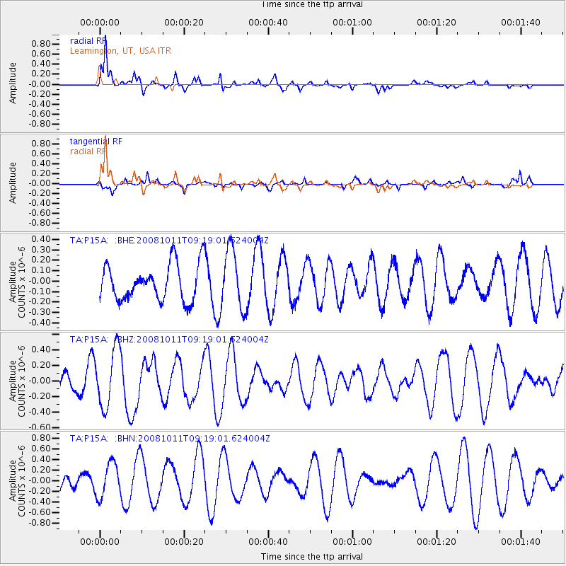
P15A Leamington, UT, USA - Earthquake Result Viewer
*The percent match for this event was below the threshold and hence no stack was calculated.
| Earthquake location: |
Eastern Caucasus |
| Earthquake latitude/longitude: |
43.4/46.3 |
| Earthquake time(UTC): |
2008/10/11 (285) 09:06:10 GMT |
| Earthquake Depth: |
16 km |
| Earthquake Magnitude: |
5.6 MB, 5.5 MS, 5.8 MW, 5.7 MW |
| Earthquake Catalog/Contributor: |
WHDF/NEIC |
|
| Network: |
TA USArray Transportable Network (new EarthScope stations) |
| Station: |
P15A Leamington, UT, USA |
| Lat/Lon: |
39.57 N/112.28 W |
| Elevation: |
1576 m |
|
| Distance: |
95.2 deg |
| Az: |
343.499 deg |
| Baz: |
15.543 deg |
| Ray Param: |
$rayparam |
*The percent match for this event was below the threshold and hence was not used in the summary stack. |
|
| Radial Match: |
83.74243 % |
| Radial Bump: |
365 |
| Transverse Match: |
42.09866 % |
| Transverse Bump: |
254 |
| SOD ConfigId: |
2560 |
| Insert Time: |
2010-03-06 10:29:47.604 +0000 |
| GWidth: |
2.5 |
| Max Bumps: |
400 |
| Tol: |
0.001 |
|
Signal To Noise
| Channel | StoN | STA | LTA |
| TA:P15A: :BHZ:20081011T09:19:01.624004Z | 2.7965338 | 3.775149E-7 | 1.3499387E-7 |
| TA:P15A: :BHN:20081011T09:19:01.624004Z | 3.5388448 | 3.245968E-7 | 9.172395E-8 |
| TA:P15A: :BHE:20081011T09:19:01.624004Z | 1.6892784 | 2.9205253E-7 | 1.7288599E-7 |
| Arrivals |
| Ps | |
| PpPs | |
| PsPs/PpSs | |


