You are here: Home > Network List > TA - USArray Transportable Network (new EarthScope stations) Stations List
> Station G31M Satah River, YT, CAN > Earthquake Result Viewer
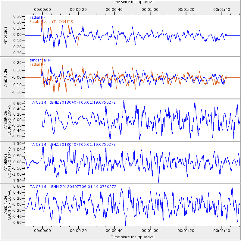
G31M Satah River, YT, CAN - Earthquake Result Viewer
*The percent match for this event was below the threshold and hence no stack was calculated.
| Earthquake location: |
New Guinea, Papua New Guinea |
| Earthquake latitude/longitude: |
-5.8/142.5 |
| Earthquake time(UTC): |
2018/04/07 (097) 05:48:38 GMT |
| Earthquake Depth: |
10 km |
| Earthquake Magnitude: |
6.3 Mww |
| Earthquake Catalog/Contributor: |
NEIC PDE/us |
|
| Network: |
TA USArray Transportable Network (new EarthScope stations) |
| Station: |
G31M Satah River, YT, CAN |
| Lat/Lon: |
66.92 N/134.27 W |
| Elevation: |
61 m |
|
| Distance: |
92.7 deg |
| Az: |
23.072 deg |
| Baz: |
261.509 deg |
| Ray Param: |
$rayparam |
*The percent match for this event was below the threshold and hence was not used in the summary stack. |
|
| Radial Match: |
76.149574 % |
| Radial Bump: |
400 |
| Transverse Match: |
61.521996 % |
| Transverse Bump: |
400 |
| SOD ConfigId: |
13570011 |
| Insert Time: |
2019-04-30 02:29:34.865 +0000 |
| GWidth: |
2.5 |
| Max Bumps: |
400 |
| Tol: |
0.001 |
|
Signal To Noise
| Channel | StoN | STA | LTA |
| TA:G31M: :BHZ:20180407T06:01:19.075027Z | 3.2631738 | 5.600973E-7 | 1.7164189E-7 |
| TA:G31M: :BHN:20180407T06:01:19.075027Z | 1.006039 | 2.2810755E-7 | 2.2673827E-7 |
| TA:G31M: :BHE:20180407T06:01:19.075027Z | 0.55099356 | 1.1195493E-7 | 2.0318737E-7 |
| Arrivals |
| Ps | |
| PpPs | |
| PsPs/PpSs | |


